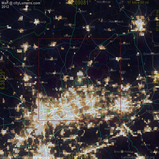
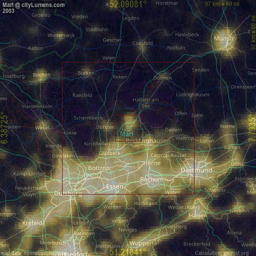
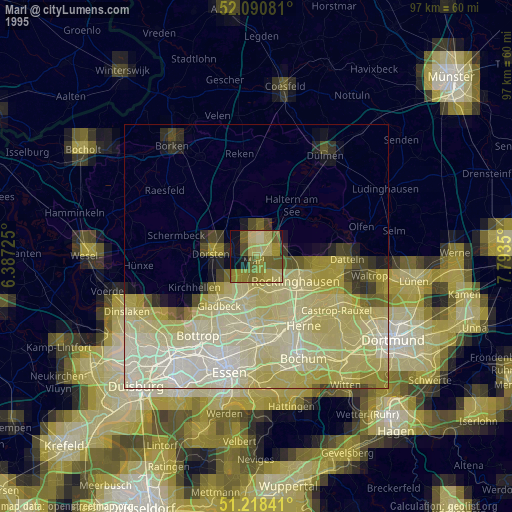
Marl night lights from space
Night Light of Marl (North Rhine-Westphalia) from space (Germany) Src. Average luminocity for 10x10km area is 38.0196% and for 50x50km: 32.3442%.

Analysis of Marl night lights 2016
Square area 10x10 km:
 4.48%
4.48%90-99
4.76%80-89
1.82%70-79
3.78%60-69
5.18%50-59
7.84%40-49
4.9%30-39
9.24%20-29
31.37%10-19
24.65%0-9
1.96%Square area 50x50 km:
7.08%90-99
7.41%80-89
4%70-79
4.44%60-69
5.09%50-59
4.59%40-49
3.47%30-39
3.59%20-29
5.06%10-19
6.4%0-9
48.86%Clear (daylight) street map image can be seen on geolist.org.
Map coordinates:
52° 5' 26.9" North, 6° 23' 14.1" East
51° 39' 24.2" North, 7° 5' 25.4" East
51° 13' 6.3" North, 7° 47' 36.6" East
Some cities around Marl sort by population:
• Recklinghausen
8.8 km =5.5 mi,  122°
122°
• Dorsten
8.7 km =5.4 mi,  273°
273°
• Gladbeck
12 km =7.5 mi,  217°
217°
• Herten
7.7 km =4.8 mi,  151°
151°
• Haltern am See
11.5 km =7.1 mi,  33°
33°
• Oer-Erkenschwick
12.1 km =7.5 mi,  97°
97°
• Klein Reken
14.9 km =9.3 mi,  347°
347°
• Schermbeck
15.7 km =9.8 mi,  280°
280°
2873263 (p: 91,398)
Sources (retrieved 2019-11-25):
» NASA, Earths city lights 1995
» NASA city lights 2003
» Earth at Night: Flat Maps 2012, 2016