Krefeld night lights from space
Night Light of Krefeld (North Rhine-Westphalia) from space (Germany) Src. Average luminocity for 10x10km area is 51.9804% and for 50x50km: 36.5708%.

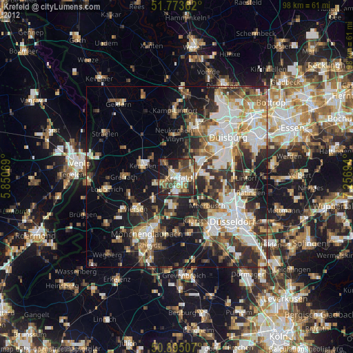
Analysis of Krefeld night lights 2016
Square area 10x10 km:
 7.98%
7.98%90-99
11.34%80-89
3.08%70-79
7%60-69
6.86%50-59
10.36%40-49
12.32%30-39
10.78%20-29
13.59%10-19
15.69%0-9
0.98%Square area 50x50 km:
7.77%90-99
8.45%80-89
3.18%70-79
3.68%60-69
3.92%50-59
4.44%40-49
5.49%30-39
6.97%20-29
9.32%10-19
14.05%0-9
32.72%Clear (daylight) street map image can be seen on geolist.org.
Map coordinates:
51° 46' 25" North, 5° 51' 2.5" East
51° 20' 11.2" North, 6° 33' 13.7" East
50° 53' 42.3" North, 7° 15' 25" East
Some cities around Krefeld sort by population:
• Moers
14.1 km =8.8 mi,  22°
22°
• Viersen
14.4 km =8.9 mi,  230°
230°
• Meerbusch
13.2 km =8.2 mi,  134°
134°
• Willich
8.1 km =5 mi,  183°
183°
• Kaarst
12.7 km =7.9 mi,  159°
159°
• Kempen
9.9 km =6.2 mi,  288°
288°
• Tönisvorst
4.5 km =2.8 mi,  247°
247°
• Grefrath
14.8 km =9.2 mi,  269°
269°
2884509 (p: 237,984)
Sources (retrieved 2019-11-25):
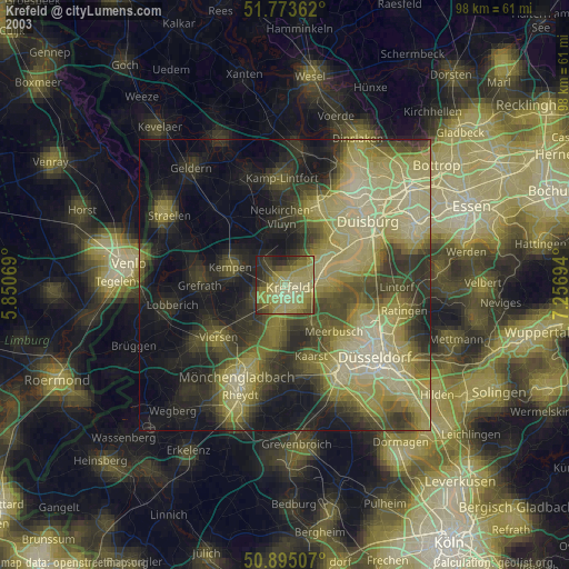
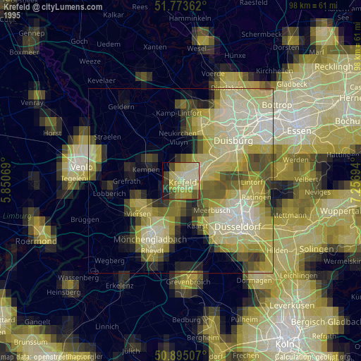
» NASA, Earths city lights 1995
» NASA city lights 2003
» Earth at Night: Flat Maps 2012, 2016