Kempen night lights from space
Night Light of Kempen (North Rhine-Westphalia) from space (Germany) Src. Average luminocity for 10x10km area is 16.2549% and for 50x50km: 28.098%.
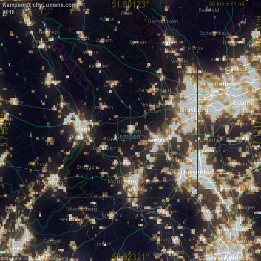
Analysis of Kempen night lights 2016
Square area 10x10 km:
 1.82%
1.82%90-99
2.66%80-89
0.84%70-79
0.84%60-69
2.38%50-59
2.94%40-49
2.66%30-39
0%20-29
0%10-19
22.13%0-9
63.73%Square area 50x50 km:
5.52%90-99
5.99%80-89
2.31%70-79
2.49%60-69
2.85%50-59
3.82%40-49
4.56%30-39
4.89%20-29
8.15%10-19
14.05%0-9
45.37%Clear (daylight) street map image can be seen on geolist.org.
Map coordinates:
51° 48' 4.4" North, 5° 42' 55.6" East
51° 21' 51.6" North, 6° 25' 6.9" East
50° 55' 23.6" North, 7° 7' 18.1" East
Some cities around Kempen sort by population:
• Krefeld
9.9 km =6.2 mi,  108°
108°
• Viersen
12.3 km =7.6 mi,  187°
187°
• Nettetal
10.8 km =6.7 mi,  240°
240°
• Tönisvorst
7.1 km =4.4 mi,  132°
132°
• Grefrath
6.2 km =3.9 mi, 240°
• Straelen
13.6 km =8.5 mi,  309°
309°
• Wachtendonk
7.4 km =4.6 mi, 312°
• Rheurdt
11.9 km =7.4 mi,  16°
16°
2891643 (p: 36,312)
Sources (retrieved 2019-11-25):
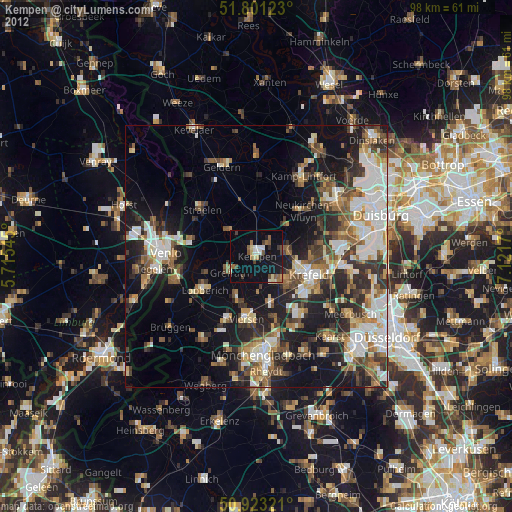
» Earth at Night: Flat Maps 2012, 2016