Kaarst night lights from space
Night Light of Kaarst (North Rhine-Westphalia) from space (Germany) Src. Average luminocity for 10x10km area is 35.8557% and for 50x50km: 36.9367%.
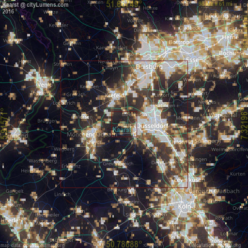
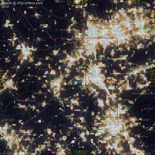
Analysis of Kaarst night lights 2016
Square area 10x10 km:
 3.08%
3.08%90-99
3.92%80-89
3.5%70-79
6.16%60-69
4.48%50-59
4.2%40-49
8.4%30-39
6.16%20-29
20.73%10-19
35.01%0-9
4.34%Square area 50x50 km:
7.27%90-99
8.21%80-89
2.92%70-79
3.47%60-69
3.91%50-59
4.77%40-49
5.87%30-39
8.26%20-29
10.63%10-19
17.08%0-9
27.61%Clear (daylight) street map image can be seen on geolist.org.
Map coordinates:
51° 40' 3" North, 5° 54' 56.6" East
51° 13' 45.4" North, 6° 37' 7.8" East
50° 47' 12.8" North, 7° 19' 19.1" East
Some cities around Kaarst sort by population:
• Düsseldorf
11 km =6.8 mi,  94°
94°
• Krefeld
12.7 km =7.9 mi,  339°
339°
• Neuss
5.8 km =3.6 mi,  126°
126°
• Meerbusch
5.5 km =3.4 mi,  61°
61°
• Willich
6.3 km =3.9 mi,  307°
307°
• Neubrück
10.6 km =6.6 mi,  172°
172°
• Korschenbroich
8.5 km =5.3 mi,  240°
240°
• Düsseldorf-Pempelfort
11.7 km =7.3 mi, 85°
2894375 (p: 42,112)
Sources (retrieved 2019-11-25):
» Earth at Night: Flat Maps 2012, 2016