Dielheim night lights from space
Night Light of Dielheim (Baden-Württemberg) from space (Germany) Src. Average luminocity for 10x10km area is 20.4251% and for 50x50km: 18.532%.
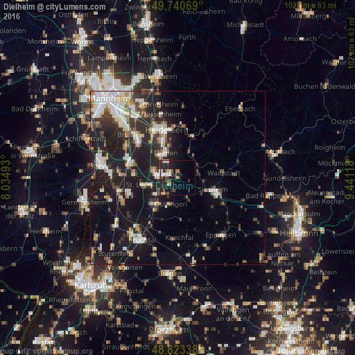
Analysis of Dielheim night lights 2016
Square area 10x10 km:
 2.27%
2.27%90-99
3.61%80-89
2.14%70-79
0.53%60-69
3.48%50-59
2.01%40-49
3.88%30-39
2.81%20-29
10.56%10-19
17.78%0-9
50.94%Square area 50x50 km:
3.21%90-99
3.58%80-89
1.66%70-79
1.38%60-69
2.01%50-59
2.07%40-49
2.18%30-39
2.68%20-29
6.7%10-19
16.72%0-9
57.8%Clear (daylight) street map image can be seen on geolist.org.
Map coordinates:
49° 44' 26.5" North, 8° 2' 5.7" East
49° 17' 3" North, 8° 44' 17" East
48° 49' 24.2" North, 9° 26' 28.2" East
Some cities around Dielheim sort by population:
• Leimen
7.9 km =4.9 mi,  332°
332°
• Wiesloch
3.1 km =1.9 mi,  292°
292°
• Walldorf
7.4 km =4.6 mi, 289°
• Östringen
7.5 km =4.7 mi,  194°
194°
• Nußloch
5.4 km =3.4 mi, 325°
• Mühlhausen
4 km =2.5 mi, 191°
• Rauenberg
3 km =1.9 mi,  236°
236°
• Meckesheim
7.2 km =4.5 mi,  54°
54°
2937407 (p: 8,999)
Sources (retrieved 2019-11-25):
» Earth at Night: Flat Maps 2012, 2016