Bonn night lights from space
Night Light of Bonn (North Rhine-Westphalia) from space (Germany) Src. Average luminocity for 10x10km area is 68.3997% and for 50x50km: 22.5282%.
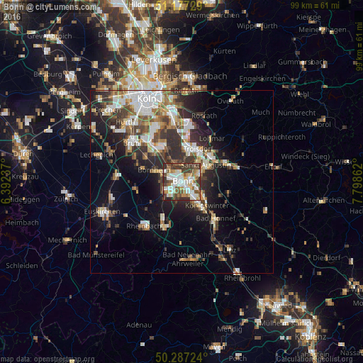
Analysis of Bonn night lights 2016
Square area 10x10 km:
 16.31%
90-99
19.52%80-89
8.42%70-79
6.68%60-69
5.08%50-59
10.96%40-49
8.82%30-39
18.45%20-29
5.75%10-19
0%0-9
0%Square area 50x50 km:
4.22%90-99
4.47%80-89
2.09%70-79
1.8%60-69
3.18%50-59
3.15%40-49
3.21%30-39
4.54%20-29
6.36%10-19
9.6%0-9
57.38%Clear (daylight) street map image can be seen on geolist.org.
Map coordinates:
51° 10' 38.2" North, 6° 23' 32.5" East
50° 44' 3.8" North, 7° 5' 43.8" East
50° 17' 14.1" North, 7° 47' 55" East
Some cities around Bonn sort by population:
• Troisdorf
9.1 km =5.7 mi,  24°
24°
• Sankt Augustin
8.5 km =5.3 mi,  57°
57°
• Bornheim
8 km =5 mi,  293°
293°
• Königswinter
8.5 km =5.3 mi,  131°
131°
• Siegburg
10.8 km =6.7 mi,  47°
47°
• Niederkassel
9.8 km =6.1 mi,  335°
335°
• Alfter
5.5 km =3.4 mi,  268°
268°
• Wachtberg
11.2 km =7 mi,  178°
178°
2946447 (p: 313,125)
Sources (retrieved 2019-11-25):
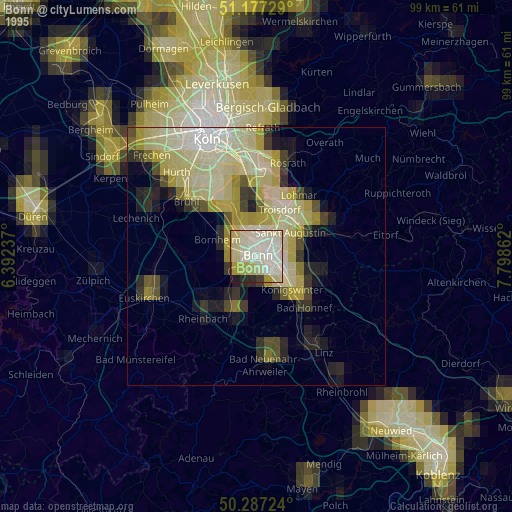
» NASA, Earths city lights 1995
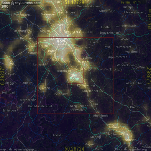
» NASA city lights 2003
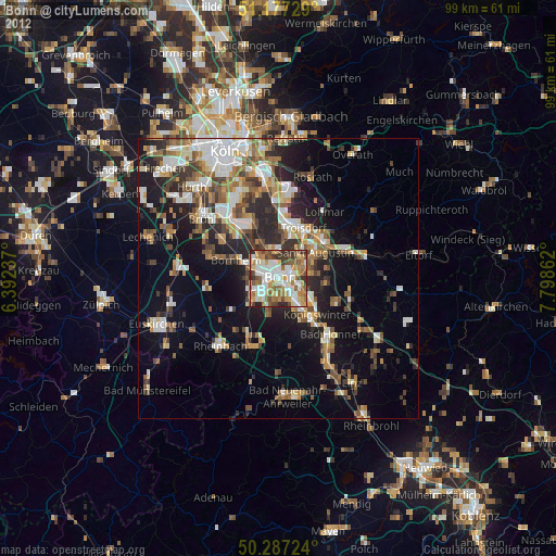
» Earth at Night: Flat Maps 2012, 2016