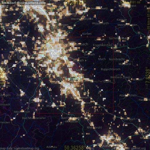
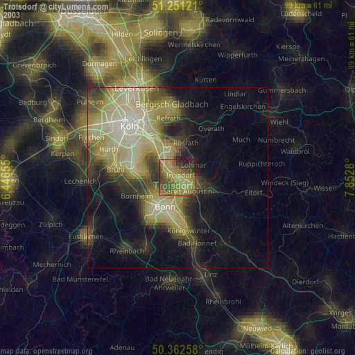
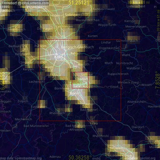
Troisdorf night lights from space
Night Light of Troisdorf (North Rhine-Westphalia) from space (Germany) Src. Average luminocity for 10x10km area is 55.2983% and for 50x50km: 26.1025%.
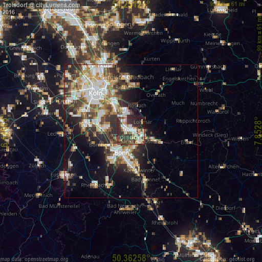
Analysis of Troisdorf night lights 2016
Square area 10x10 km:
 10.78%
90-99
12.61%80-89
6.72%70-79
4.9%60-69
5.46%50-59
5.46%40-49
6.02%30-39
24.93%20-29
17.51%10-19
5.32%0-9
0.28%Square area 50x50 km:
5.09%90-99
5.55%80-89
2.56%70-79
2.44%60-69
3.86%50-59
3.48%40-49
3.55%30-39
5.16%20-29
6.76%10-19
9.11%0-9
52.43%Clear (daylight) street map image can be seen on geolist.org.
Map coordinates:
51° 15' 4.4" North, 6° 26' 47.6" East
50° 48' 32.4" North, 7° 8' 58.8" East
50° 21' 45.3" North, 7° 51' 10.1" East
Some cities around Troisdorf sort by population:
• Bonn
9.1 km =5.7 mi,  204°
204°
• Sankt Augustin
5 km =3.1 mi,  138°
138°
• Hennef
10.1 km =6.3 mi,  111°
111°
• Siegburg
4.2 km =2.6 mi,  103°
103°
• Niederkassel
7.9 km =4.9 mi,  274°
274°
• Lohmar
5.6 km =3.5 mi,  53°
53°
• Rösrath
9.9 km =6.2 mi,  13°
13°
• Wahn-Heide
6.3 km =3.9 mi,  331°
331°
2821029 (p: 74,749)
Sources (retrieved 2019-11-25):
» NASA, Earths city lights 1995
» NASA city lights 2003
» Earth at Night: Flat Maps 2012, 2016