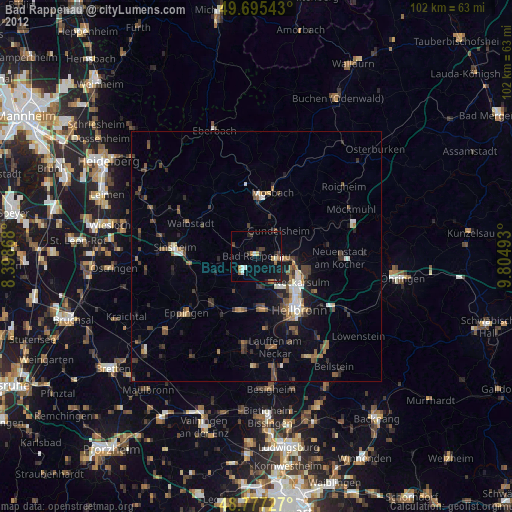
Bad Rappenau night lights from space
Night Light of Bad Rappenau (Baden-Württemberg) from space (Germany) Src. Average luminocity for 10x10km area is 11.4773% and for 50x50km: 7.2776%.
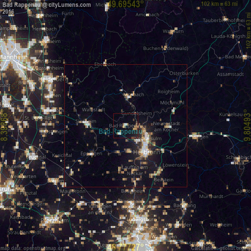
Analysis of Bad Rappenau night lights 2016
Square area 10x10 km:
 0.8%
0.8%90-99
1.34%80-89
0%70-79
1.87%60-69
2.41%50-59
2.81%40-49
0.67%30-39
0.8%20-29
0.8%10-19
9.89%0-9
78.61%Square area 50x50 km:
0.77%90-99
0.74%80-89
0.62%70-79
0.68%60-69
0.93%50-59
1.36%40-49
1.21%30-39
1.39%20-29
1.87%10-19
4.77%0-9
85.66%Clear (daylight) street map image can be seen on geolist.org.
Map coordinates:
49° 41' 43.5" North, 8° 23' 55.2" East
49° 14' 18.5" North, 9° 6' 6.5" East
48° 46' 38.2" North, 9° 48' 17.7" East
Some cities around Bad Rappenau sort by population:
• Neckarsulm
10.5 km =6.5 mi,  121°
121°
• Schwaigern
10.9 km =6.8 mi,  198°
198°
• Leingarten
10.3 km =6.4 mi,  173°
173°
• Gundelsheim
6.5 km =4 mi,  40°
40°
• Bad Wimpfen
4.1 km =2.5 mi,  103°
103°
• Oedheim
11 km =6.8 mi,  88°
88°
• Kirchardt
8.8 km =5.5 mi,  245°
245°
• Obrigheim
12.6 km =7.8 mi,  356°
356°
2953374 (p: 20,581)
Sources (retrieved 2019-11-25):
» Earth at Night: Flat Maps 2012, 2016