Obrigheim night lights from space
Night Light of Obrigheim (Baden-Württemberg) from space (Germany) Src. Average luminocity for 10x10km area is 8.2981% and for 50x50km: 5.2519%.
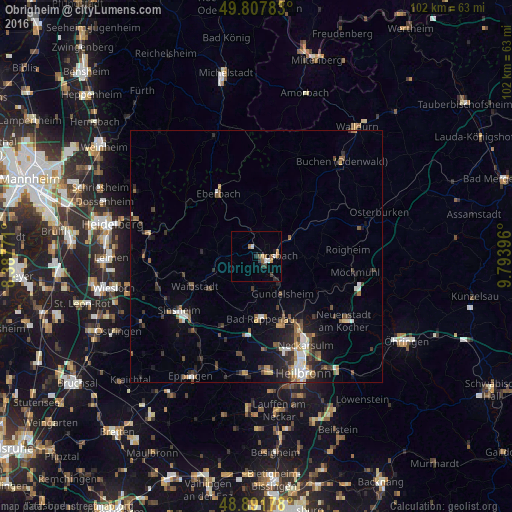
Analysis of Obrigheim night lights 2016
Square area 10x10 km:
 0.67%
0.67%90-99
1.47%80-89
0.67%70-79
0.94%60-69
1.47%50-59
1.34%40-49
1.07%30-39
1.6%20-29
1.07%10-19
1.47%0-9
88.24%Square area 50x50 km:
0.73%90-99
0.64%80-89
0.37%70-79
0.45%60-69
0.72%50-59
0.96%40-49
0.77%30-39
1.1%20-29
1.48%10-19
2.54%0-9
90.24%Clear (daylight) street map image can be seen on geolist.org.
Map coordinates:
49° 48' 28.2" North, 8° 23' 15.8" East
49° 21' 7" North, 9° 5' 27" East
48° 53' 30.4" North, 9° 47' 38.3" East
Some cities around Obrigheim sort by population:
• Mosbach
4.4 km =2.7 mi,  87°
87°
• Bad Rappenau
12.6 km =7.8 mi,  176°
176°
• Eberbach
14.7 km =9.1 mi,  330°
330°
• Gundelsheim
9.1 km =5.7 mi,  146°
146°
• Bad Wimpfen
14.4 km =8.9 mi,  160°
160°
• Billigheim
11.8 km =7.3 mi, 91°
• Waibstadt
14.1 km =8.8 mi,  243°
243°
• Neudenau
14.6 km =9.1 mi,  117°
117°
2858417 (p: 5,299)
Sources (retrieved 2019-11-25):
» Earth at Night: Flat Maps 2012, 2016