Rionegro night lights from space
Night Light of Rionegro (Antioquia) from space (Colombia) Src. Average luminocity for 10x10km area is 58.7707% and for 50x50km: 22.3903%.
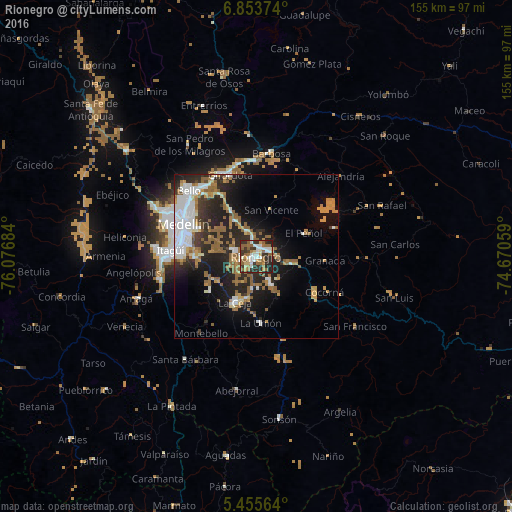
Analysis of Rionegro night lights 2016
Square area 10x10 km:
 10.74%
90-99
11.36%80-89
5.79%70-79
6.61%60-69
12.6%50-59
15.5%40-49
0.62%30-39
12.4%20-29
22.52%10-19
1.86%0-9
0%Square area 50x50 km:
4.55%90-99
3.31%80-89
1.47%70-79
3.09%60-69
3.84%50-59
4.98%40-49
0.55%30-39
2.47%20-29
8.4%10-19
11.65%0-9
55.69%Clear (daylight) street map image can be seen on geolist.org.
Map coordinates:
6° 51' 13.5" North, 76° 4' 36.6" West
6° 9' 18.5" North, 75° 22' 25.4" West
5° 27' 20.3" North, 74° 40' 14.1" West
Some cities around Rionegro sort by population:
• La Ceja
15.3 km =9.5 mi,  205°
205°
• Marinilla
4.6 km =2.9 mi,  63°
63°
• Carmen de Viboral
9.2 km =5.7 mi,  152°
152°
• Santuario
12.3 km =7.6 mi,  98°
98°
• Guarne
15.9 km =9.9 mi,  331°
331°
• La Unión
20.1 km =12.5 mi,  176°
176°
• Retiro
17.9 km =11.1 mi,  233°
233°
• San Vicente
15.1 km =9.4 mi,  16°
16°
3670730 (p: 62,291)
Sources (retrieved 2019-11-25):
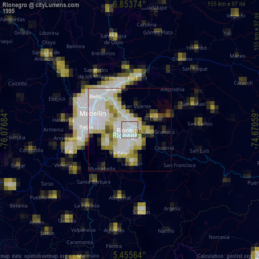
» NASA, Earths city lights 1995
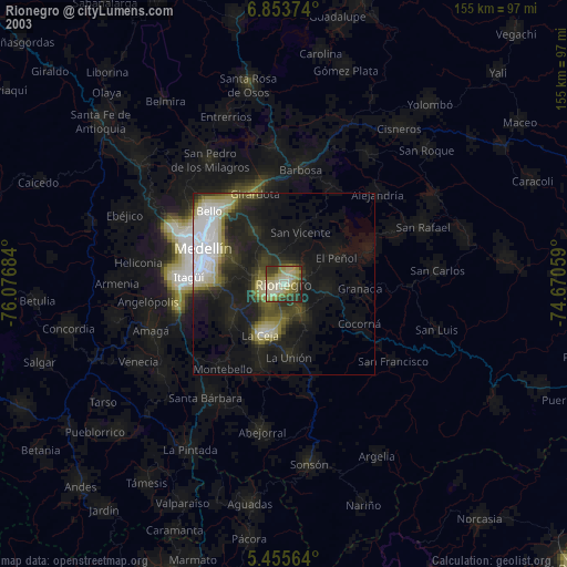
» NASA city lights 2003
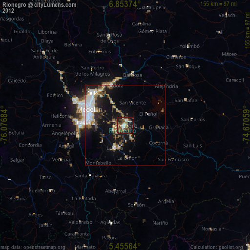
» Earth at Night: Flat Maps 2012, 2016