Wuhai night lights from space
Night Light of Wuhai (Inner Mongolia) from space (China) Src. Average luminocity for 10x10km area is 51.8977% and for 50x50km: 6.0757%.
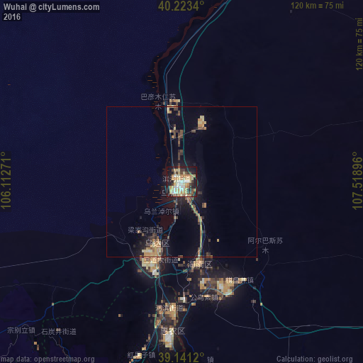
Analysis of Wuhai night lights 2016
Square area 10x10 km:
 4.55%
4.55%90-99
9.74%80-89
14.61%70-79
11.85%60-69
7.14%50-59
1.3%40-49
5.84%30-39
6.17%20-29
11.69%10-19
25%0-9
2.11%Square area 50x50 km:
0.19%90-99
0.45%80-89
1.12%70-79
1.02%60-69
1.2%50-59
0.58%40-49
1.04%30-39
1.11%20-29
1.3%10-19
4.58%0-9
87.42%Clear (daylight) street map image can be seen on geolist.org.
Map coordinates:
40° 13' 24.2" North, 106° 6' 45.8" East
39° 41' 3.9" North, 106° 48' 57" East
39° 8' 28.3" North, 107° 31' 8.3" East
Some cities around Wuhai sort by population:
• Ordos
254 km =157.8 mi,  91°
91°
• Bayan Nur
127.1 km =79 mi,  22°
22°
• Yinchuan
143.1 km =88.9 mi,  199°
199°
• Shizuishan
50.3 km =31.3 mi,  184°
184°
• Dawukou
80 km =49.7 mi,  206°
206°
• Wuda
22.4 km =13.9 mi, 203°
• Dongsheng
270.7 km =168.2 mi, 86°
• Shitanjing
64.4 km =40 mi,  218°
218°
1791249 (p: 218,427)
Sources (retrieved 2019-11-25):
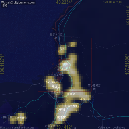
» NASA, Earths city lights 1995
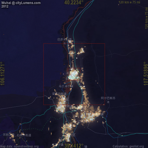
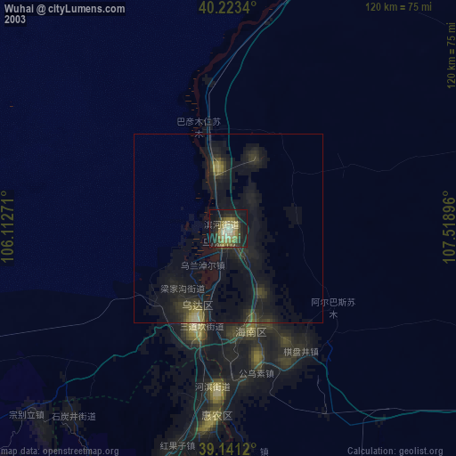
» NASA city lights 2003
» Earth at Night: Flat Maps 2012, 2016