Shitanjing night lights from space
Night Light of Shitanjing (Ningxia Hui Autonomous Region) from space (China) Src. Average luminocity for 10x10km area is 0.4983% and for 50x50km: 1.9246%.
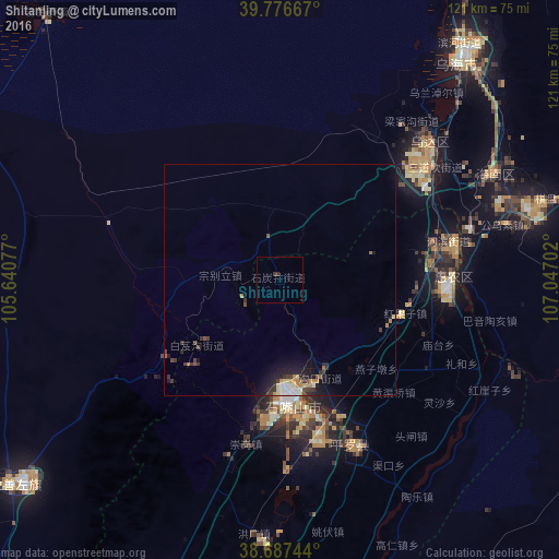
Analysis of Shitanjing night lights 2016
Square area 10x10 km:
 0%
0%90-99
0%80-89
0%70-79
0%60-69
0%50-59
0%40-49
0%30-39
1.36%20-29
0%10-19
0%0-9
98.64%Square area 50x50 km:
0.18%90-99
0.21%80-89
0.27%70-79
0.15%60-69
0.32%50-59
0.17%40-49
0.29%30-39
0.63%20-29
0.52%10-19
1.5%0-9
95.74%Clear (daylight) street map image can be seen on geolist.org.
Map coordinates:
39° 46' 36" North, 105° 38' 26.8" East
39° 14' 3" North, 106° 20' 38" East
38° 41' 14.8" North, 107° 2' 49.3" East
Some cities around Shitanjing sort by population:
• Ordos
298.2 km =185.3 mi,  81°
81°
• Bayan Nur
189.6 km =117.8 mi,  27°
27°
• Yinchuan
85.4 km =53.1 mi,  184°
184°
• Wuhai
64.4 km =40 mi,  38°
38°
• Shizuishan
36.7 km =22.8 mi,  90°
90°
• Dawukou
21.8 km =13.5 mi,  168°
168°
• Wuda
43.2 km =26.8 mi,  46°
46°
• Yulinshi
312.3 km =194.1 mi,  109°
109°
1794971 (p: 78,765)
Sources (retrieved 2019-11-25):
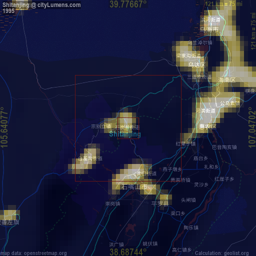
» NASA, Earths city lights 1995
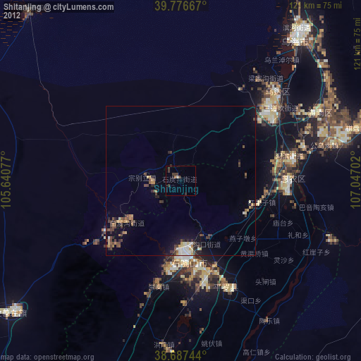
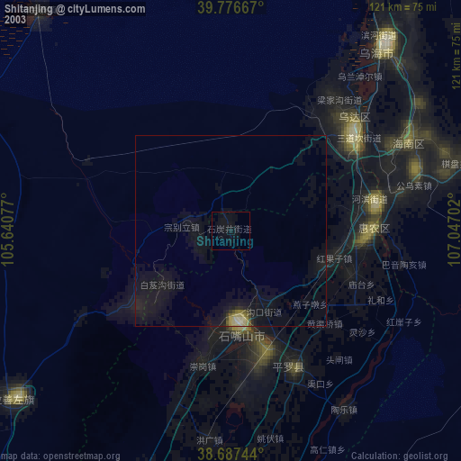
» NASA city lights 2003
» Earth at Night: Flat Maps 2012, 2016