Shizuishan night lights from space
Night Light of Shizuishan (Ningxia Hui Autonomous Region) from space (China) Src. Average luminocity for 10x10km area is 33.4796% and for 50x50km: 7.5391%.
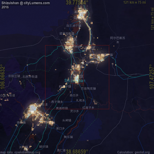
Analysis of Shizuishan night lights 2016
Square area 10x10 km:
 2.89%
2.89%90-99
3.91%80-89
6.63%70-79
3.74%60-69
3.23%50-59
4.59%40-49
4.08%30-39
10.54%20-29
11.73%10-19
32.65%0-9
15.99%Square area 50x50 km:
0.25%90-99
0.42%80-89
1.07%70-79
1.54%60-69
1.11%50-59
0.72%40-49
1.32%30-39
2.24%20-29
1.86%10-19
7.74%0-9
81.74%Clear (daylight) street map image can be seen on geolist.org.
Map coordinates:
39° 46' 33" North, 106° 3' 58.8" East
39° 13' 60" North, 106° 46' 10" East
38° 41' 11.7" North, 107° 28' 21.3" East
Some cities around Shizuishan sort by population:
• Ordos
262.1 km =162.9 mi,  80°
80°
• Bayan Nur
175.7 km =109.2 mi,  17°
17°
• Yinchuan
95.3 km =59.2 mi,  206°
206°
• Wuhai
50.3 km =31.3 mi,  4°
4°
• Dawukou
38.6 km =24 mi,  236°
236°
• Wuda
30 km =18.6 mi,  350°
350°
• Yulinshi
277.8 km =172.6 mi,  112°
112°
• Shitanjing
36.7 km =22.8 mi,  270°
270°
1794806 (p: 136,570)
Sources (retrieved 2019-11-25):
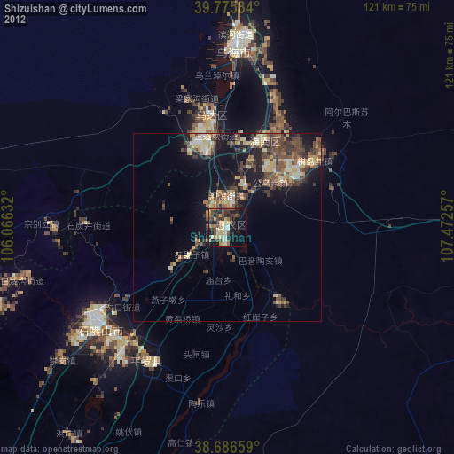
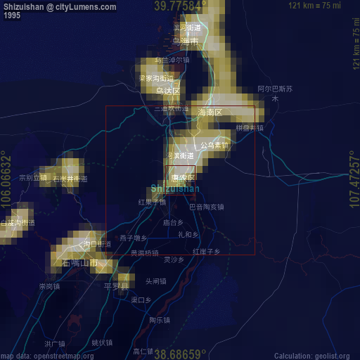
» NASA, Earths city lights 1995
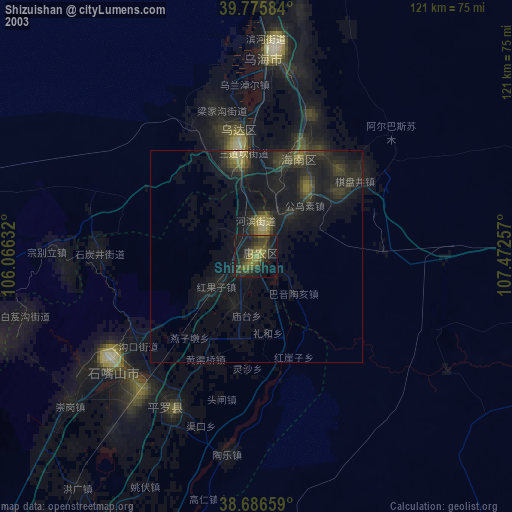
» NASA city lights 2003
» Earth at Night: Flat Maps 2012, 2016