Ordos night lights from space
Night Light of Ordos (Inner Mongolia) from space (China) Src. Average luminocity for 10x10km area is 26.9529% and for 50x50km: 7.7269%.
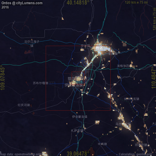
Analysis of Ordos night lights 2016
Square area 10x10 km:
 0%
0%90-99
1.3%80-89
2.6%70-79
6.49%60-69
6.17%50-59
5.52%40-49
6.49%30-39
6.49%20-29
3.25%10-19
33.6%0-9
28.08%Square area 50x50 km:
0.99%90-99
1.63%80-89
0.81%70-79
0.97%60-69
0.71%50-59
0.63%40-49
1.24%30-39
1.38%20-29
1.55%10-19
5.89%0-9
84.21%Clear (daylight) street map image can be seen on geolist.org.
Map coordinates:
40° 8' 53.4" North, 109° 4' 42.4" East
39° 36' 31" North, 109° 46' 53.7" East
39° 3' 53.2" North, 110° 29' 4.9" East
Some cities around Ordos sort by population:
• Bayan Nur
239.3 km =148.7 mi,  301°
301°
• Baotou
116.1 km =72.1 mi,  1°
1°
• Hohhot
207.6 km =129 mi,  49°
49°
• Wuhai
254 km =157.8 mi,  271°
271°
• Dongsheng
28.5 km =17.7 mi,  36°
36°
• Yulinshi
146.5 km =91 mi,  181°
181°
• Shiguai
129.3 km =80.3 mi,  19°
19°
• Salaqi
120.9 km =75.1 mi,  30°
30°
8347664 (p: 1,940,653)
Sources (retrieved 2019-11-25):
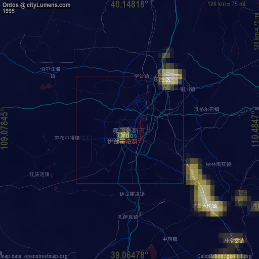
» NASA, Earths city lights 1995
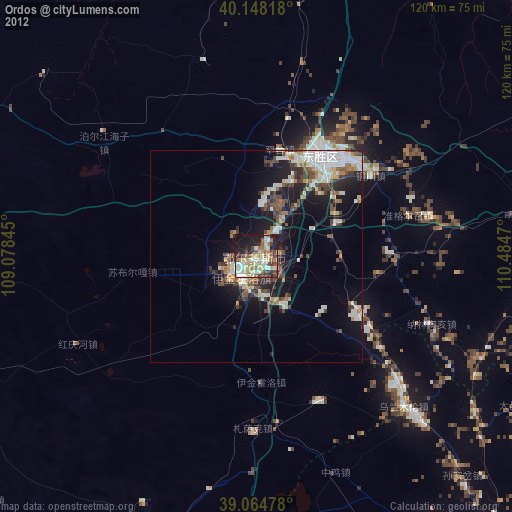
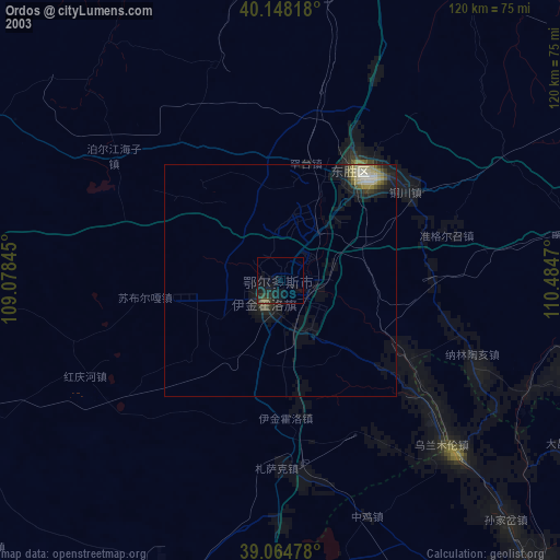
» NASA city lights 2003
» Earth at Night: Flat Maps 2012, 2016