Dawukou night lights from space
Night Light of Dawukou (Ningxia Hui Autonomous Region) from space (China) Src. Average luminocity for 10x10km area is 37.9302% and for 50x50km: 6.9229%.
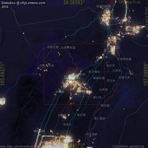
Analysis of Dawukou night lights 2016
Square area 10x10 km:
 7.95%
7.95%90-99
7.31%80-89
6.33%70-79
3.73%60-69
5.52%50-59
1.46%40-49
2.76%30-39
6.33%20-29
10.06%10-19
23.38%0-9
25.16%Square area 50x50 km:
0.46%90-99
0.67%80-89
1.04%70-79
1.08%60-69
1.42%50-59
0.57%40-49
1.3%30-39
1.76%20-29
2.29%10-19
4.4%0-9
85.01%Clear (daylight) street map image can be seen on geolist.org.
Map coordinates:
39° 35' 9.3" North, 105° 41' 33.8" East
39° 2' 31" North, 106° 23' 45" East
38° 29' 37.4" North, 107° 5' 56.3" East
Some cities around Dawukou sort by population:
• Ordos
297.9 km =185.1 mi,  77°
77°
• Bayan Nur
207 km =128.6 mi,  24°
24°
• Yinchuan
64.7 km =40.2 mi,  189°
189°
• Wuhai
80 km =49.7 mi,  26°
26°
• Shizuishan
38.6 km =24 mi,  56°
56°
• Wuda
57.7 km =35.9 mi, 28°
• Yulinshi
301.8 km =187.5 mi,  106°
106°
• Shitanjing
21.8 km =13.5 mi,  348°
348°
1813344 (p: 131,880)
Sources (retrieved 2019-11-25):
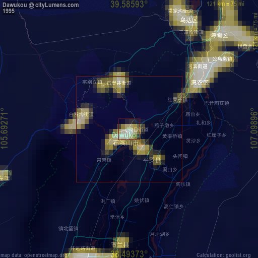
» NASA, Earths city lights 1995
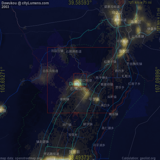
» NASA city lights 2003
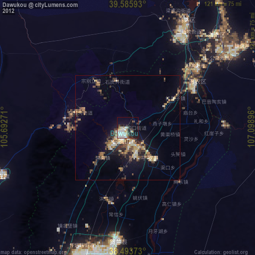
» Earth at Night: Flat Maps 2012, 2016