Wuda night lights from space
Night Light of Wuda (Inner Mongolia) from space (China) Src. Average luminocity for 10x10km area is 32.3117% and for 50x50km: 10.0605%.
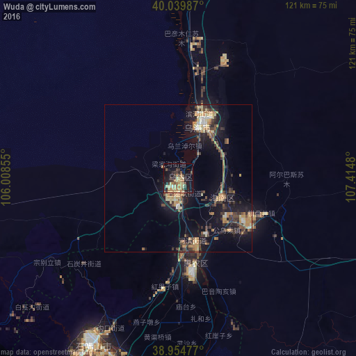
Analysis of Wuda night lights 2016
Square area 10x10 km:
 0.16%
0.16%90-99
1.3%80-89
7.63%70-79
6.98%60-69
10.55%50-59
2.27%40-49
4.38%30-39
7.47%20-29
6.01%10-19
26.46%0-9
26.79%Square area 50x50 km:
0.32%90-99
0.71%80-89
1.55%70-79
2.01%60-69
1.95%50-59
0.96%40-49
1.72%30-39
2.33%20-29
2.41%10-19
9.25%0-9
76.79%Clear (daylight) street map image can be seen on geolist.org.
Map coordinates:
40° 2' 23.5" North, 106° 0' 30.8" East
39° 29' 58" North, 106° 42' 42" East
38° 57' 17.2" North, 107° 24' 53.3" East
Some cities around Wuda sort by population:
• Ordos
263.4 km =163.7 mi,  87°
87°
• Bayan Nur
149.5 km =92.9 mi,  22°
22°
• Yinchuan
120.8 km =75.1 mi,  198°
198°
• Wuhai
22.4 km =13.9 mi, 23°
• Shizuishan
30 km =18.6 mi,  170°
170°
• Dawukou
57.7 km =35.9 mi,  208°
208°
• Dongsheng
281.8 km =175.1 mi,  82°
82°
• Shitanjing
43.2 km =26.8 mi,  226°
226°
1791325 (p: 129,922)
Sources (retrieved 2019-11-25):
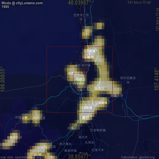
» NASA, Earths city lights 1995
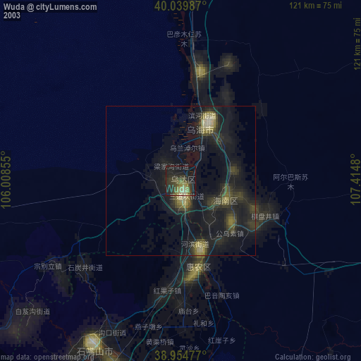
» NASA city lights 2003
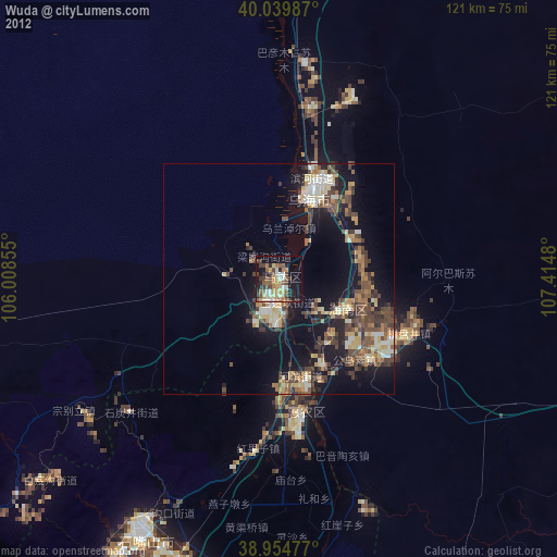
» Earth at Night: Flat Maps 2012, 2016