Dongsheng night lights from space
Night Light of Dongsheng (Inner Mongolia) from space (China) Src. Average luminocity for 10x10km area is 70.6599% and for 50x50km: 8.5184%.
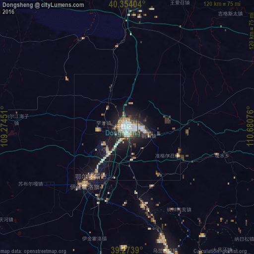
Analysis of Dongsheng night lights 2016
Square area 10x10 km:
 20.92%
90-99
19.56%80-89
5.44%70-79
12.41%60-69
5.95%50-59
4.76%40-49
12.07%30-39
5.44%20-29
12.07%10-19
1.36%0-9
0%Square area 50x50 km:
1.03%90-99
1.67%80-89
0.86%70-79
1.01%60-69
0.8%50-59
0.7%40-49
1.4%30-39
1.76%20-29
2.25%10-19
7.26%0-9
81.26%Clear (daylight) street map image can be seen on geolist.org.
Map coordinates:
40° 21' 14.5" North, 109° 16' 28.2" East
39° 48' 57.9" North, 109° 58' 39.5" East
39° 16' 26" North, 110° 40' 50.7" East
Some cities around Dongsheng sort by population:
• Ordos
28.5 km =17.7 mi,  216°
216°
• Bayan Nur
242.7 km =150.8 mi,  295°
295°
• Baotou
93.9 km =58.3 mi,  351°
351°
• Hohhot
180 km =111.8 mi,  52°
52°
• Yulinshi
170.7 km =106.1 mi,  186°
186°
• Yuanping
268.8 km =167 mi,  117°
117°
• Shiguai
102.3 km =63.6 mi,  14°
14°
• Salaqi
92.5 km =57.5 mi,  29°
29°
1812256 (p: 99,809)
Sources (retrieved 2019-11-25):
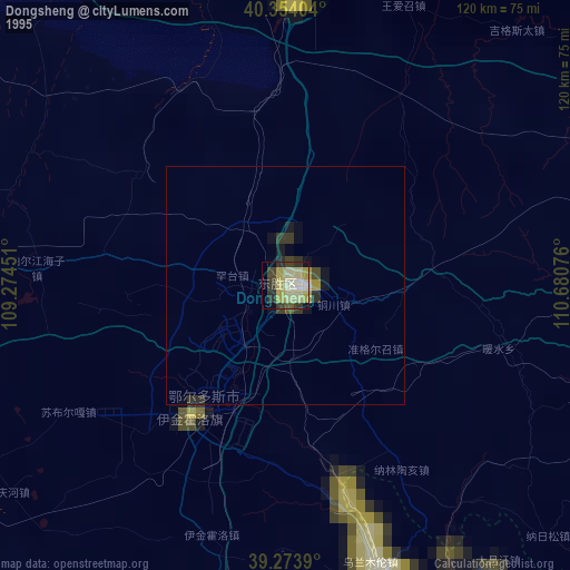
» NASA, Earths city lights 1995
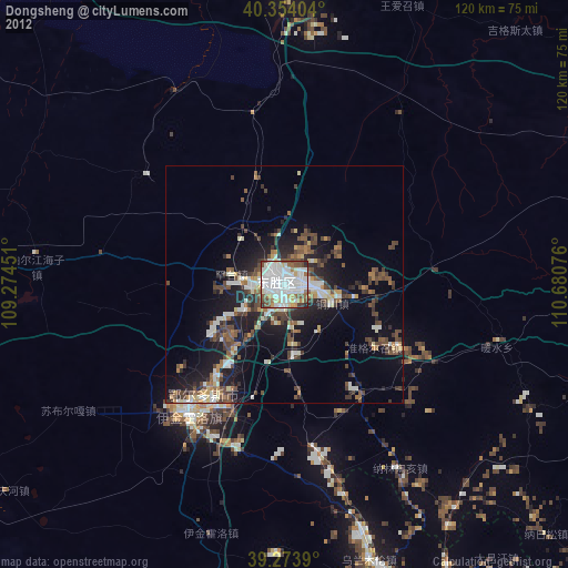
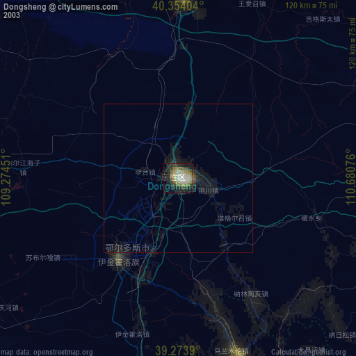
» NASA city lights 2003
» Earth at Night: Flat Maps 2012, 2016