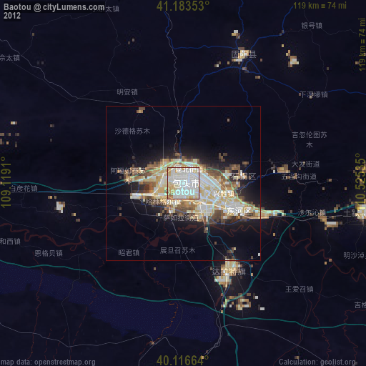
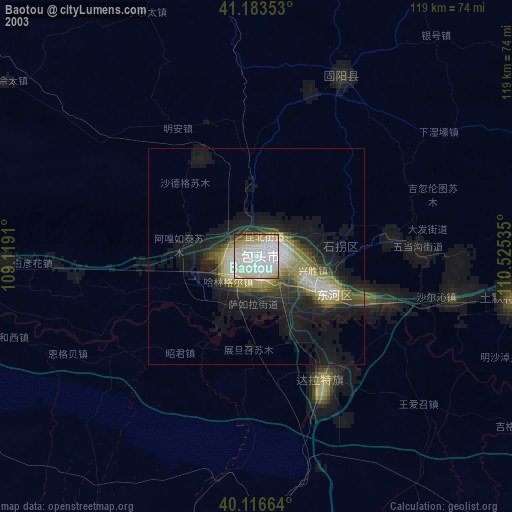
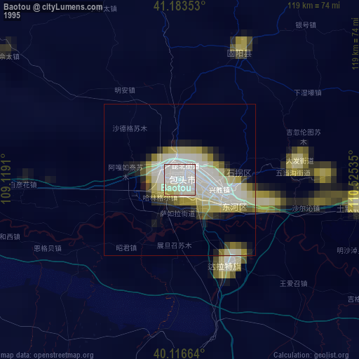
Baotou night lights from space
Night Light of Baotou (Inner Mongolia) from space (China) Src. Average luminocity for 10x10km area is 92.0958% and for 50x50km: 20.2937%.
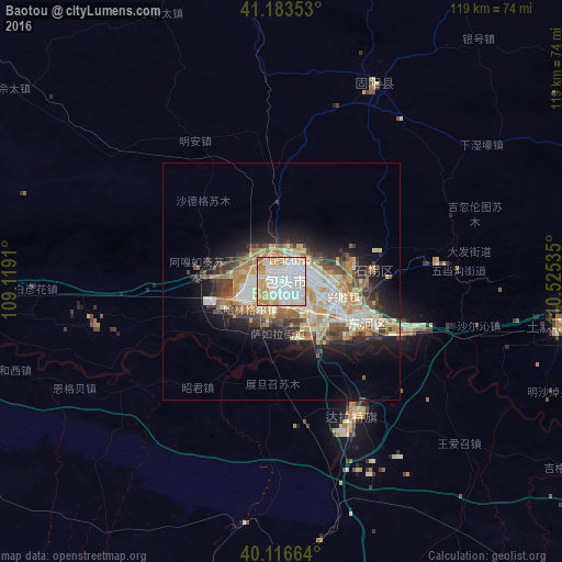
Analysis of Baotou night lights 2016
Square area 10x10 km:
 39.94%
90-99
29.38%80-89
10.88%70-79
14.77%60-69
4.38%50-59
0.65%40-49
0%30-39
0%20-29
0%10-19
0%0-9
0%Square area 50x50 km:
3.18%90-99
4.81%80-89
2.67%70-79
3.95%60-69
2.65%50-59
1.72%40-49
2.82%30-39
2.47%20-29
3.66%10-19
7.6%0-9
64.47%Clear (daylight) street map image can be seen on geolist.org.
Map coordinates:
41° 11' 0.7" North, 109° 7' 8.8" East
40° 39' 8" North, 109° 49' 20" East
40° 6' 59.9" North, 110° 31' 31.3" East
Some cities around Baotou sort by population:
• Ordos
116.1 km =72.1 mi,  181°
181°
• Bayan Nur
205.6 km =127.8 mi,  272°
272°
• Hohhot
155.2 km =96.4 mi,  83°
83°
• Wuhai
277.2 km =172.2 mi,  247°
247°
• Dongsheng
93.9 km =58.3 mi,  171°
171°
• Yulinshi
262.6 km =163.2 mi, 181°
• Shiguai
39.5 km =24.5 mi, 81°
• Salaqi
59.4 km =36.9 mi,  101°
101°
2038432 (p: 1,301,768)
Sources (retrieved 2019-11-25):
» NASA, Earths city lights 1995
» NASA city lights 2003
» Earth at Night: Flat Maps 2012, 2016