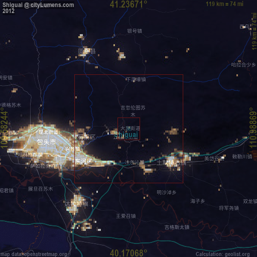
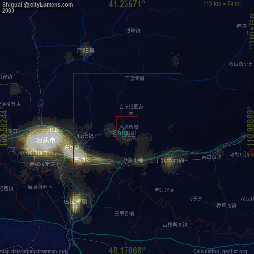
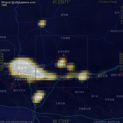
Shiguai night lights from space
Night Light of Shiguai (Inner Mongolia) from space (China) Src. Average luminocity for 10x10km area is 1.7695% and for 50x50km: 5.7362%.
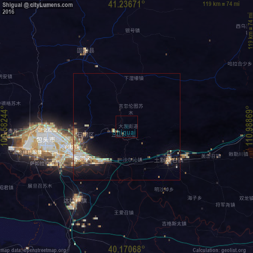
Analysis of Shiguai night lights 2016
Square area 10x10 km:
 0%
0%90-99
0%80-89
0.16%70-79
0.49%60-69
0.32%50-59
0.32%40-49
0%30-39
0.49%20-29
0.97%10-19
1.14%0-9
96.1%Square area 50x50 km:
0.37%90-99
1.01%80-89
0.75%70-79
0.92%60-69
1.06%50-59
0.49%40-49
0.91%30-39
1.06%20-29
1.49%10-19
3.67%0-9
88.27%Clear (daylight) street map image can be seen on geolist.org.
Map coordinates:
41° 14' 12.2" North, 109° 34' 56.8" East
40° 42' 21" North, 110° 17' 8" East
40° 10' 14.4" North, 110° 59' 19.3" East
Some cities around Shiguai sort by population:
• Ordos
129.3 km =80.3 mi,  199°
199°
• Bayan Nur
244.4 km =151.9 mi,  270°
270°
• Baotou
39.5 km =24.5 mi,  261°
261°
• Hohhot
115.7 km =71.9 mi,  84°
84°
• Jining
239.8 km =149 mi, 81°
• Dongsheng
102.3 km =63.6 mi,  194°
194°
• Beichengqu
244 km =151.6 mi,  96°
96°
• Salaqi
26.4 km =16.4 mi,  133°
133°
2034918 (p: 70,357)
Sources (retrieved 2019-11-25):
» NASA, Earths city lights 1995
» NASA city lights 2003
» Earth at Night: Flat Maps 2012, 2016