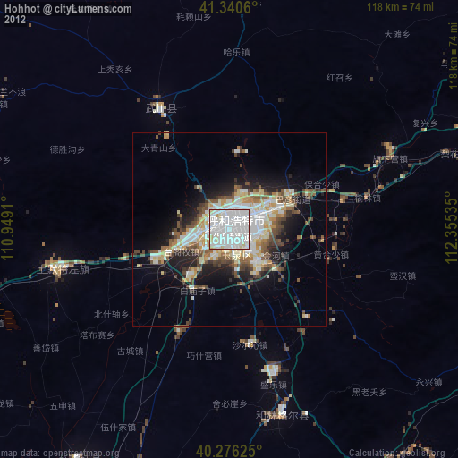
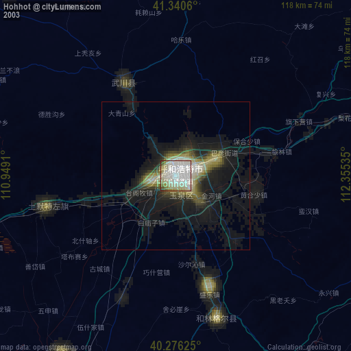
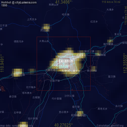
Hohhot night lights from space
Night Light of Hohhot (Inner Mongolia) from space (China) Src. Average luminocity for 10x10km area is 97.7466% and for 50x50km: 20.5683%.
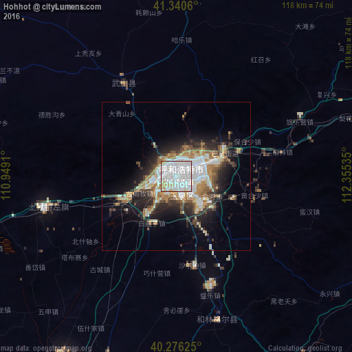
Analysis of Hohhot night lights 2016
Square area 10x10 km:
 64.12%
90-99
27.04%80-89
5.27%70-79
3.57%60-69
0%50-59
0%40-49
0%30-39
0%20-29
0%10-19
0%0-9
0%Square area 50x50 km:
5.13%90-99
4.17%80-89
1.72%70-79
2.64%60-69
2.8%50-59
1.68%40-49
2.57%30-39
2.9%20-29
4.63%10-19
8.6%0-9
63.16%Clear (daylight) street map image can be seen on geolist.org.
Map coordinates:
41° 20' 26.2" North, 110° 56' 56.8" East
40° 48' 38" North, 111° 39' 8" East
40° 16' 34.5" North, 112° 21' 19.3" East
Some cities around Hohhot sort by population:
• Ordos
207.6 km =129 mi,  229°
229°
• Baotou
155.2 km =96.4 mi,  263°
263°
• Datong
160 km =99.4 mi,  119°
119°
• Jining
124.5 km =77.4 mi,  78°
78°
• Dongsheng
180 km =111.8 mi, 232°
• Beichengqu
133.3 km =82.8 mi,  108°
108°
• Shiguai
115.7 km =71.9 mi, 264°
• Salaqi
100.8 km =62.6 mi,  252°
252°
2036892 (p: 774,477)
Sources (retrieved 2019-11-25):
» NASA, Earths city lights 1995
» NASA city lights 2003
» Earth at Night: Flat Maps 2012, 2016