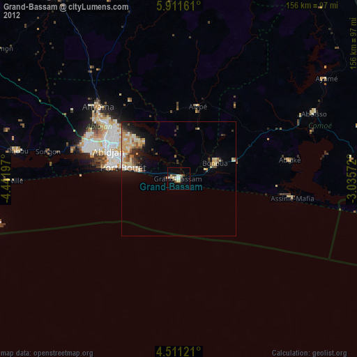
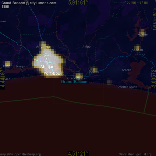
Grand-Bassam night lights from space
Night Light of Grand-Bassam (Comoé) from space (Ivory Coast) Src. Average luminocity for 10x10km area is 33.2603% and for 50x50km: 10.687%.
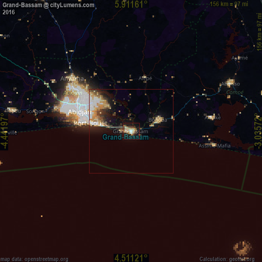

Analysis of Grand-Bassam night lights 2016
Square area 10x10 km:
 3.93%
3.93%90-99
3.31%80-89
5.58%70-79
5.99%60-69
6.2%50-59
2.69%40-49
6.4%30-39
4.34%20-29
3.1%10-19
39.26%0-9
19.21%Square area 50x50 km:
1.4%90-99
1.64%80-89
1.56%70-79
2.08%60-69
1.54%50-59
0.78%40-49
1.72%30-39
1.6%20-29
2.1%10-19
5.83%0-9
79.74%Clear (daylight) street map image can be seen on geolist.org.
Map coordinates:
5° 54' 41.8" North, 4° 26' 31.1" West
5° 12' 42.5" North, 3° 44' 19.8" West
4° 30' 40.4" North, 3° 2' 8.6" West
Some cities around Grand-Bassam sort by population:
• Abidjan
33.1 km =20.6 mi,  298°
298°
• Abobo
38.2 km =23.7 mi,  306°
306°
• Anyama
46.8 km =29.1 mi, 312°
• Dabou
71.8 km =44.6 mi,  280°
280°
• Bingerville
22.8 km =14.2 mi, 314°
• Aboisso
65.4 km =40.6 mi,  64°
64°
• Bonoua
17.2 km =10.7 mi,  66°
66°
• Adiaké
48.9 km =30.4 mi,  80°
80°
2288115 (p: 73,772)
Sources (retrieved 2019-11-25):
» NASA, Earths city lights 1995
» NASA city lights 2003
» Earth at Night: Flat Maps 2012, 2016