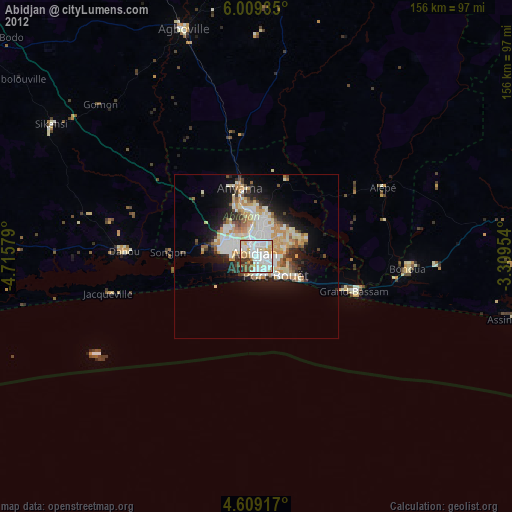
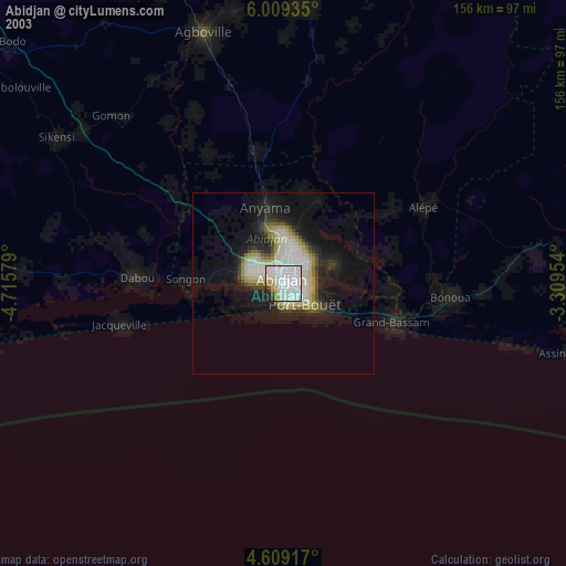
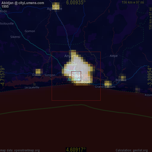
Abidjan night lights from space
Night Light of Abidjan from space (Ivory Coast) Src. Average luminocity for 10x10km area is 93.0393% and for 50x50km: 25.4286%.
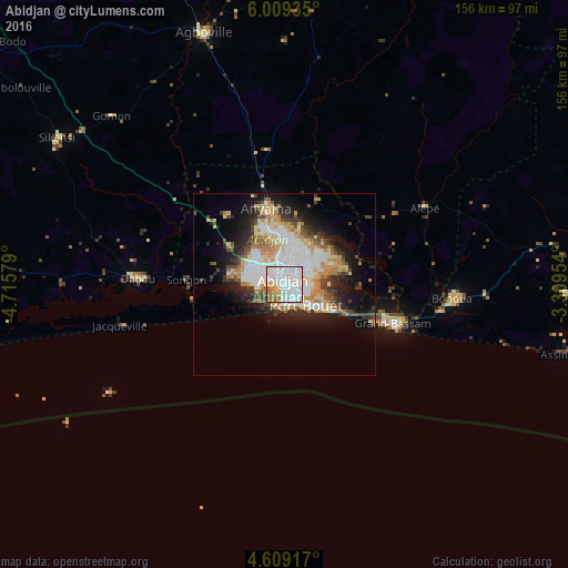
Analysis of Abidjan night lights 2016
Square area 10x10 km:
 48.35%
90-99
29.96%80-89
5.37%70-79
4.96%60-69
8.06%50-59
2.48%40-49
0.83%30-39
0%20-29
0%10-19
0%0-9
0%Square area 50x50 km:
6.56%90-99
5.5%80-89
3.02%70-79
3.41%60-69
3.17%50-59
1.47%40-49
2.79%30-39
3.15%20-29
4.77%10-19
9.27%0-9
56.9%Clear (daylight) street map image can be seen on geolist.org.
Map coordinates:
6° 0' 33.7" North, 4° 42' 56.8" West
5° 21' 16" North, 4° 0' 6" West
4° 36' 33" North, 3° 18' 34.3" West
Some cities around Abidjan sort by population:
• Abobo
7 km =4.3 mi,  347°
347°
• Anyama
16.5 km =10.3 mi,  340°
340°
• Agboville
67.9 km =42.2 mi, 339°
• Grand-Bassam
33.1 km =20.6 mi,  118°
118°
• Dabou
41.7 km =25.9 mi,  265°
265°
• Bingerville
12.9 km =8 mi,  89°
89°
• Bonoua
45.8 km =28.5 mi,  101°
101°
• Adiaké
77.6 km =48.2 mi, 95°
2293538 (p: 3,677,115)
Sources (retrieved 2019-11-25):
» NASA, Earths city lights 1995
» NASA city lights 2003
» Earth at Night: Flat Maps 2012, 2016