Kipushi night lights from space
Night Light of Kipushi (Haut-Katanga) from space (Democratic Republic of the Congo) Src. Average luminocity for 10x10km area is 10.3698% and for 50x50km: 4.8029%.
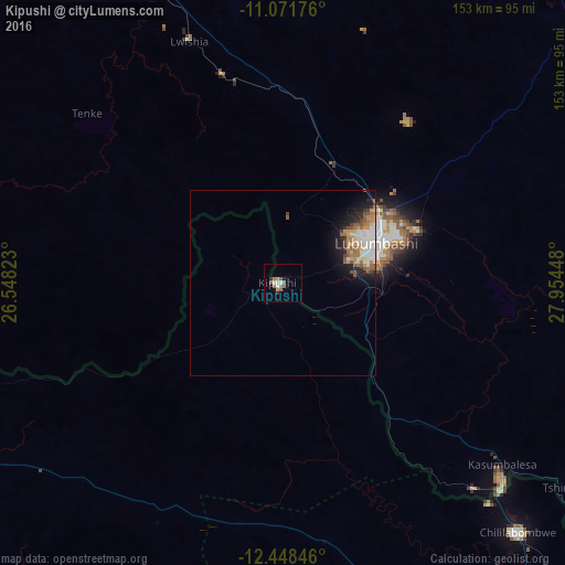
Analysis of Kipushi night lights 2016
Square area 10x10 km:
 1.03%
1.03%90-99
2.07%80-89
0.21%70-79
1.45%60-69
2.69%50-59
2.48%40-49
1.65%30-39
0.83%20-29
0.83%10-19
0.83%0-9
85.95%Square area 50x50 km:
1.04%90-99
0.71%80-89
0.4%70-79
0.66%60-69
0.75%50-59
1%40-49
0.55%30-39
0.38%20-29
0.92%10-19
2.34%0-9
91.25%Clear (daylight) street map image can be seen on geolist.org.
Map coordinates:
11° 4' 18.3" South, 26° 32' 53.6" East
11° 45' 39.5" South, 27° 15' 4.9" East
12° 26' 54.5" South, 27° 57' 16.1" East
Some cities around Kipushi sort by population:
• Lubumbashi
27.2 km =16.9 mi,  65°
65°
• Likasi
103 km =64 mi,  327°
327°
• Chingola, ZM
109.6 km =68.1 mi,  141°
141°
• Chililabombwe, ZM
91.5 km =56.9 mi, 137°
• Kansanshi, ZM
97 km =60.3 mi,  247°
247°
• Kambove
121.7 km =75.6 mi,  324°
324°
• Chambishi, ZM
130.4 km =81 mi, 138°
• Solwezi, ZM
104.1 km =64.7 mi,  244°
244°
922806 (p: 62,332)
Sources (retrieved 2019-11-25):
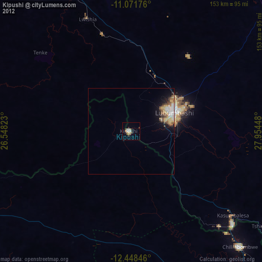
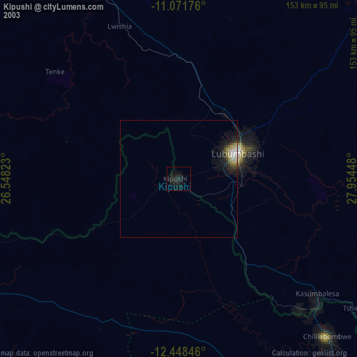
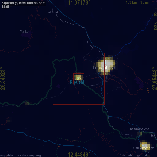
» NASA, Earths city lights 1995
» NASA city lights 2003
» Earth at Night: Flat Maps 2012, 2016