Solwezi night lights from space
Night Light of Solwezi (North-Western) from space (Zambia) Src. Average luminocity for 10x10km area is 45.4525% and for 50x50km: 4.123%.
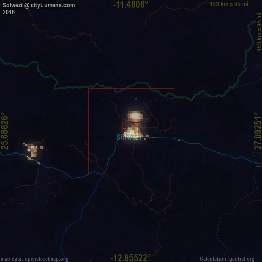
Analysis of Solwezi night lights 2016
Square area 10x10 km:
 0.41%
0.41%90-99
1.65%80-89
10.74%70-79
16.32%60-69
5.37%50-59
9.3%40-49
12.6%30-39
4.55%20-29
13.64%10-19
21.69%0-9
3.72%Square area 50x50 km:
0.28%90-99
0.29%80-89
0.52%70-79
0.93%60-69
0.51%50-59
0.76%40-49
0.96%30-39
0.39%20-29
0.99%10-19
3.93%0-9
90.45%Clear (daylight) street map image can be seen on geolist.org.
Map coordinates:
11° 28' 50.2" South, 25° 41' 10.5" East
12° 10' 7.7" South, 26° 23' 21.8" East
12° 51' 18.8" South, 27° 5' 33" East
Some cities around Solwezi sort by population:
• Lubumbashi, CD
131.3 km =81.6 mi,  64°
64°
• Likasi, CD
137.2 km =85.3 mi,  16°
16°
• Chingola
167.2 km =103.9 mi,  103°
103°
• Kipushi, CD
104.1 km =64.7 mi, 64°
• Chililabombwe
157.3 km =97.7 mi, 97°
• Kansanshi
9.2 km =5.7 mi,  26°
26°
• Kambove, CD
145.8 km =90.6 mi,  8°
8°
• Kasempa
155.5 km =96.6 mi,  202°
202°
897045 (p: 4,846)
Sources (retrieved 2019-11-25):
» Earth at Night: Flat Maps 2012, 2016