Kansanshi night lights from space
Night Light of Kansanshi (North-Western) from space (Zambia) Src. Average luminocity for 10x10km area is 39.7665% and for 50x50km: 4.1381%.
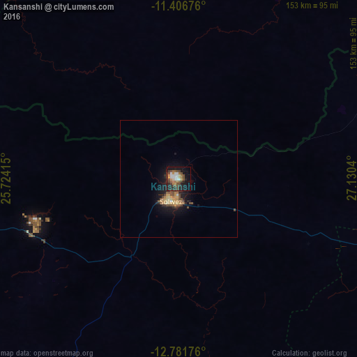
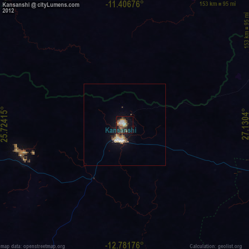
Analysis of Kansanshi night lights 2016
Square area 10x10 km:
 6.4%
6.4%90-99
5.37%80-89
2.07%70-79
5.99%60-69
6.61%50-59
6.2%40-49
11.57%30-39
4.96%20-29
11.98%10-19
26.24%0-9
12.6%Square area 50x50 km:
0.28%90-99
0.29%80-89
0.52%70-79
0.93%60-69
0.51%50-59
0.76%40-49
0.99%30-39
0.39%20-29
0.99%10-19
3.93%0-9
90.42%Clear (daylight) street map image can be seen on geolist.org.
Map coordinates:
11° 24' 24.3" South, 25° 43' 26.9" East
12° 5' 42.5" South, 26° 25' 38.2" East
12° 46' 54.3" South, 27° 7' 49.4" East
Some cities around Kansanshi sort by population:
• Lubumbashi, CD
124.2 km =77.2 mi,  67°
67°
• Likasi, CD
128.2 km =79.7 mi,  15°
15°
• Chingola
165.4 km =102.8 mi,  106°
106°
• Kipushi, CD
97 km =60.3 mi, 67°
• Chililabombwe
154.6 km =96.1 mi,  101°
101°
• Kambove, CD
137.1 km =85.2 mi,  7°
7°
• Kasempa
164.7 km =102.3 mi,  203°
203°
• Solwezi
9.2 km =5.7 mi,  206°
206°
913613 (p: 40,705)
Sources (retrieved 2019-11-25):
» Earth at Night: Flat Maps 2012, 2016