Tonota night lights from space
Night Light of Tonota (Central) from space (Botswana) Src. Average luminocity for 10x10km area is 14.1004% and for 50x50km: 1.6247%.
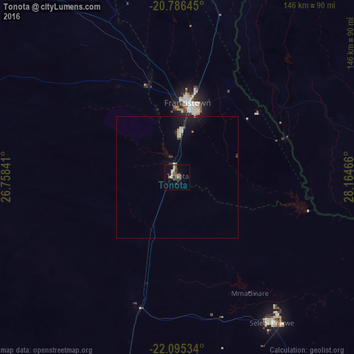
Analysis of Tonota night lights 2016
Square area 10x10 km:
 0.57%
0.57%90-99
0.19%80-89
3.6%70-79
1.7%60-69
2.27%50-59
2.08%40-49
3.98%30-39
3.6%20-29
1.7%10-19
1.52%0-9
78.79%Square area 50x50 km:
0.07%90-99
0.1%80-89
0.38%70-79
0.12%60-69
0.15%50-59
0.12%40-49
0.27%30-39
0.31%20-29
0.38%10-19
1.43%0-9
96.67%Clear (daylight) street map image can be seen on geolist.org.
Map coordinates:
20° 47' 11.2" South, 26° 45' 30.3" East
21° 26' 32.5" South, 27° 27' 41.5" East
22° 5' 43.2" South, 28° 9' 52.8" East
Some cities around Tonota sort by population:
• Bulawayo, ZW
185.1 km =115 mi,  39°
39°
• Francistown
30.7 km =19.1 mi,  8°
8°
• Selebi-Phikwe
71.5 km =44.4 mi,  146°
146°
• Serowe
130.5 km =81.1 mi,  216°
216°
• Mahalapye
196.4 km =122 mi,  199°
199°
• Palapye
127.5 km =79.2 mi, 195°
• Letlhakane
193.5 km =120.2 mi,  270°
270°
• Gwanda, ZW
169.8 km =105.5 mi,  70°
70°
933000 (p: 17,759)
Sources (retrieved 2019-11-25):
» Earth at Night: Flat Maps 2012, 2016