Rio Branco night lights from space
Night Light of Rio Branco (Acre) from space (Brazil) Src. Average luminocity for 10x10km area is 85.8388% and for 50x50km: 10.4812%.
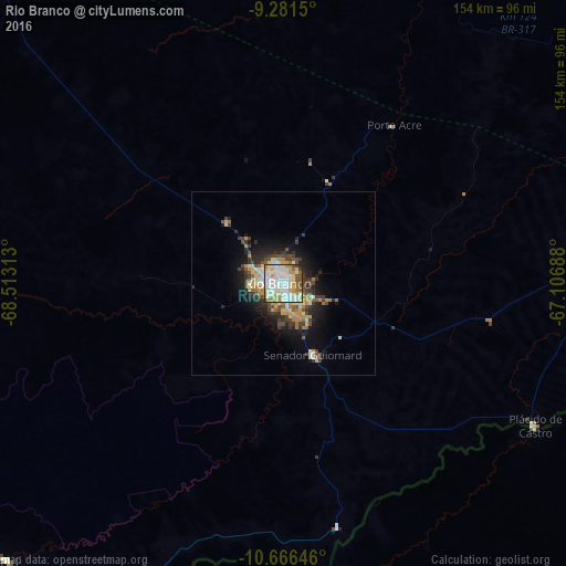
Analysis of Rio Branco night lights 2016
Square area 10x10 km:
 30.37%
90-99
27.27%80-89
13.43%70-79
12.19%60-69
3.31%50-59
7.85%40-49
3.93%30-39
0.83%20-29
0.83%10-19
0%0-9
0%Square area 50x50 km:
1.51%90-99
2.1%80-89
1.28%70-79
1.63%60-69
1.06%50-59
0.99%40-49
1.78%30-39
2.05%20-29
2.35%10-19
5.51%0-9
79.76%Clear (daylight) street map image can be seen on geolist.org.
Map coordinates:
9° 16' 53.4" South, 68° 30' 47.3" West
9° 58' 29" South, 67° 48' 36" West
10° 39' 59.3" South, 67° 6' 24.8" West
Some cities around Rio Branco sort by population:
• Cobija, BO
157.1 km =97.6 mi,  221°
221°
• Sena Madureira
138.6 km =86.1 mi,  316°
316°
• Boca do Acre
143.3 km =89 mi,  18°
18°
• Plácido de Castro
79.2 km =49.2 mi,  120°
120°
• Senador Guiomard
21 km =13 mi,  157°
157°
• Brasiléia
154.7 km =96.1 mi, 221°
• Extrema
160.9 km =100 mi,  81°
81°
• Xapuri
106.9 km =66.4 mi,  225°
225°
3662574 (p: 257,642)
Sources (retrieved 2019-11-25):
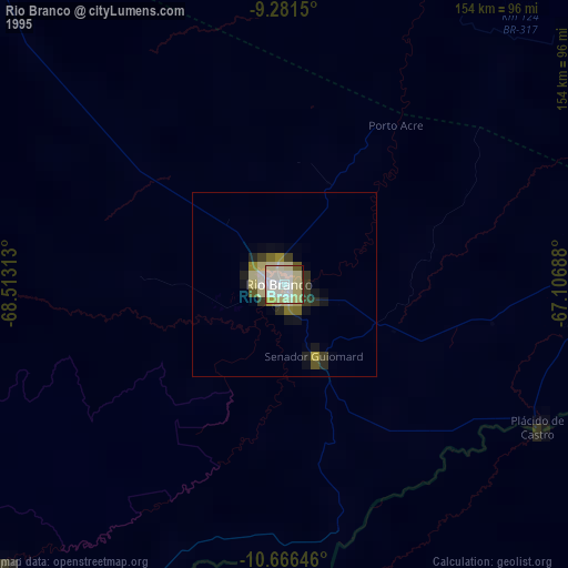
» NASA, Earths city lights 1995
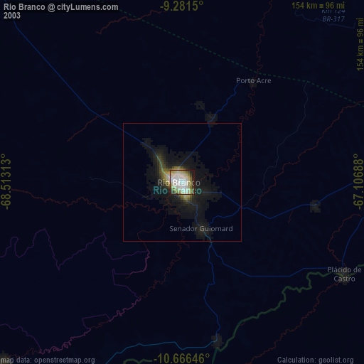
» NASA city lights 2003
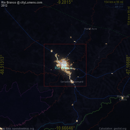
» Earth at Night: Flat Maps 2012, 2016