Planaltina night lights from space
Night Light of Planaltina (Federal District) from space (Brazil) Src. Average luminocity for 10x10km area is 58.2165% and for 50x50km: 20.4319%.
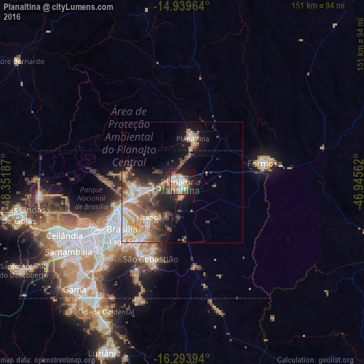
Analysis of Planaltina night lights 2016
Square area 10x10 km:
 10.39%
90-99
13.42%80-89
4.33%70-79
21%60-69
4.11%50-59
2.81%40-49
8.87%30-39
5.84%20-29
12.55%10-19
15.8%0-9
0.87%Square area 50x50 km:
3.05%90-99
3.39%80-89
1.76%70-79
5.26%60-69
2.44%50-59
2.95%40-49
3.76%30-39
2.53%20-29
4.46%10-19
8.64%0-9
61.78%Clear (daylight) street map image can be seen on geolist.org.
Map coordinates:
14° 56' 22.7" South, 48° 21' 6.7" West
15° 37' 4.5" South, 47° 38' 55.5" West
16° 17' 38.2" South, 46° 56' 44.2" West
Some cities around Planaltina sort by population:
• Brasília
35 km =21.7 mi,  239°
239°
• Luziânia
77.6 km =48.2 mi,  204°
204°
• Formosa
34.8 km =21.6 mi,  75°
75°
• Unaí
114.3 km =71 mi,  136°
136°
• Cristalina
127.9 km =79.5 mi,  178°
178°
• Buritis
131.2 km =81.5 mi,  89°
89°
• Padre Bernardo
84.5 km =52.5 mi,  306°
306°
• Abadiânia
130.6 km =81.2 mi, 240°
11184422 (p: 189,412)
Sources (retrieved 2019-11-25):
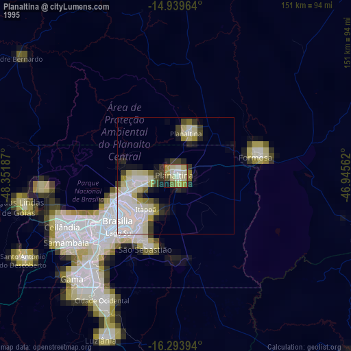
» NASA, Earths city lights 1995
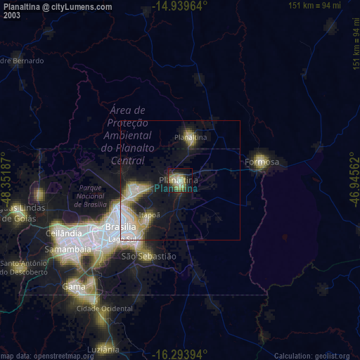
» NASA city lights 2003
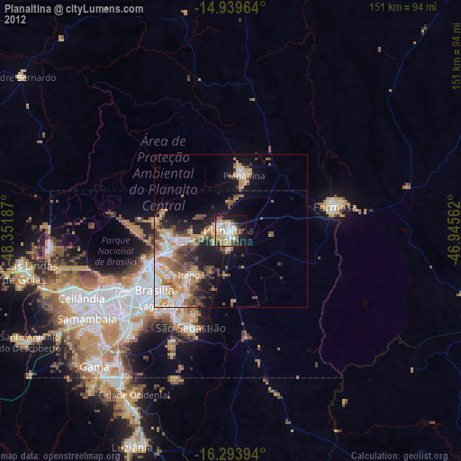
» Earth at Night: Flat Maps 2012, 2016