Formosa night lights from space
Night Light of Formosa (Goiás) from space (Brazil) Src. Average luminocity for 10x10km area is 44.0411% and for 50x50km: 2.6912%.
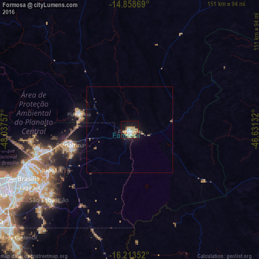

Analysis of Formosa night lights 2016
Square area 10x10 km:
 7.14%
7.14%90-99
6.28%80-89
8.87%70-79
13.64%60-69
4.76%50-59
3.25%40-49
1.95%30-39
1.08%20-29
3.68%10-19
37.01%0-9
12.34%Square area 50x50 km:
0.28%90-99
0.24%80-89
0.35%70-79
0.72%60-69
0.26%50-59
0.24%40-49
0.23%30-39
0.16%20-29
0.37%10-19
2.92%0-9
94.23%Clear (daylight) street map image can be seen on geolist.org.
Map coordinates:
14° 51' 31.3" South, 48° 2' 15.3" West
15° 32' 14" South, 47° 20' 4" West
16° 12' 48.7" South, 46° 37' 52.8" West
Some cities around Formosa sort by population:
• Brasília
69.2 km =43 mi,  247°
247°
• Planaltina
34.8 km =21.6 mi,  255°
255°
• Luziânia
103.3 km =64.2 mi,  219°
219°
• Planaltina
31.4 km =19.5 mi,  287°
287°
• Unaí
102.1 km =63.4 mi,  153°
153°
• Buritis
98 km =60.9 mi,  95°
95°
• Padre Bernardo
109.7 km =68.2 mi, 292°
• Arinos
138.1 km =85.8 mi,  107°
107°
3463140 (p: 81,232)
Sources (retrieved 2019-11-25):
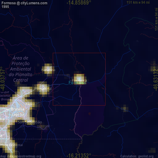
» NASA, Earths city lights 1995
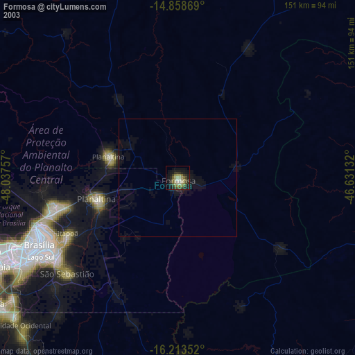
» NASA city lights 2003
» Earth at Night: Flat Maps 2012, 2016