Padre Bernardo night lights from space
Night Light of Padre Bernardo (Goiás) from space (Brazil) Src. Average luminocity for 10x10km area is 9.2231% and for 50x50km: 0.5039%.
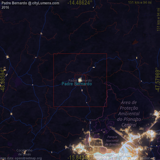
Analysis of Padre Bernardo night lights 2016
Square area 10x10 km:
 0.41%
0.41%90-99
0.41%80-89
1.45%70-79
4.34%60-69
0.62%50-59
0.62%40-49
2.69%30-39
1.03%20-29
0%10-19
0.83%0-9
87.6%Square area 50x50 km:
0.02%90-99
0.02%80-89
0.06%70-79
0.27%60-69
0.06%50-59
0.06%40-49
0.11%30-39
0.04%20-29
0%10-19
0.03%0-9
99.34%Clear (daylight) street map image can be seen on geolist.org.
Map coordinates:
14° 29' 10.5" South, 48° 59' 9.4" West
15° 9' 57.4" South, 48° 16' 58.1" West
15° 50' 36.5" South, 47° 34' 46.9" West
Some cities around Padre Bernardo sort by population:
• Brasília
78 km =48.5 mi,  150°
150°
• Planaltina
84.5 km =52.5 mi,  126°
126°
• Planaltina
78.5 km =48.8 mi,  113°
113°
• Formosa
109.7 km =68.2 mi, 112°
• Goianésia
91.1 km =56.6 mi,  259°
259°
• Niquelândia
79.3 km =49.3 mi,  346°
346°
• Pirenópolis
105.2 km =65.4 mi,  223°
223°
• Barro Alto
71.3 km =44.3 mi,  287°
287°
3455580 (p: 16,118)
Sources (retrieved 2019-11-25):
» Earth at Night: Flat Maps 2012, 2016