Luziânia night lights from space
Night Light of Luziânia (Goiás) from space (Brazil) Src. Average luminocity for 10x10km area is 56.1012% and for 50x50km: 15.2289%.
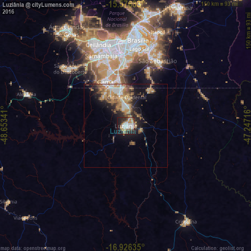

Analysis of Luziânia night lights 2016
Square area 10x10 km:
 14.26%
90-99
14.67%80-89
3.31%70-79
10.95%60-69
3.93%50-59
1.24%40-49
9.71%30-39
6.82%20-29
16.94%10-19
17.77%0-9
0.41%Square area 50x50 km:
2.07%90-99
2.27%80-89
1.09%70-79
3.95%60-69
2.31%50-59
1.84%40-49
3.17%30-39
1.48%20-29
4.14%10-19
7.37%0-9
70.3%Clear (daylight) street map image can be seen on geolist.org.
Map coordinates:
15° 34' 34.8" South, 48° 39' 12.3" West
16° 15' 9" South, 47° 57' 1" West
16° 55' 34.9" South, 47° 14' 49.8" West
Some cities around Luziânia sort by population:
• Brasília
52.6 km =32.7 mi,  2°
2°
• Planaltina
77.6 km =48.2 mi,  24°
24°
• Planaltina
95.9 km =59.6 mi, 22°
• Cristalina
67.5 km =41.9 mi,  148°
148°
• Silvânia
83.4 km =51.8 mi,  237°
237°
• Vianópolis
81.3 km =50.5 mi,  227°
227°
• Orizona
94.1 km =58.5 mi,  203°
203°
• Abadiânia
81 km =50.3 mi,  273°
273°
3458329 (p: 143,601)
Sources (retrieved 2019-11-25):
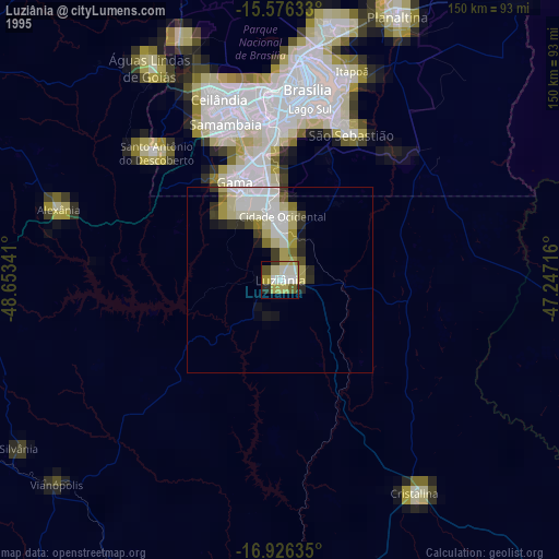
» NASA, Earths city lights 1995
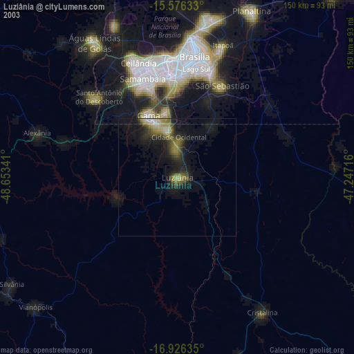
» NASA city lights 2003
» Earth at Night: Flat Maps 2012, 2016