Luís Correia night lights from space
Night Light of Luís Correia (Piauí) from space (Brazil) Src. Average luminocity for 10x10km area is 31.816% and for 50x50km: 7.4609%.
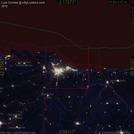
Analysis of Luís Correia night lights 2016
Square area 10x10 km:
 1.95%
1.95%90-99
6.71%80-89
4.11%70-79
2.81%60-69
4.55%50-59
7.36%40-49
1.73%30-39
7.36%20-29
7.58%10-19
32.68%0-9
23.16%Square area 50x50 km:
0.8%90-99
1.57%80-89
0.61%70-79
0.46%60-69
0.89%50-59
1.39%40-49
1.19%30-39
1.25%20-29
2.39%10-19
5.41%0-9
84.05%Clear (daylight) street map image can be seen on geolist.org.
Map coordinates:
2° 10' 36.2" South, 42° 22' 12.3" West
2° 52' 45" South, 41° 40' 1" West
3° 34' 52.2" South, 40° 57' 49.8" West
Some cities around Luís Correia sort by population:
• Parnaíba
12.5 km =7.8 mi,  256°
256°
• Camocim
91.7 km =57 mi,  91°
91°
• Barroquinha
61 km =37.9 mi,  104°
104°
• Tutóia
68.7 km =42.7 mi,  280°
280°
• Cocal
67 km =41.6 mi,  169°
169°
• Buriti dos Lopes
39.7 km =24.7 mi,  214°
214°
• Araioses
26.2 km =16.3 mi,  267°
267°
• Juá dos Vieiras
83.4 km =51.8 mi,  150°
150°
3396121 (p: 11,479)
Sources (retrieved 2019-11-25):
» Earth at Night: Flat Maps 2012, 2016