Juá dos Vieiras night lights from space
Night Light of Juá dos Vieiras (Ceará) from space (Brazil) Src. Average luminocity for 10x10km area is 2.3593% and for 50x50km: 1.1531%.
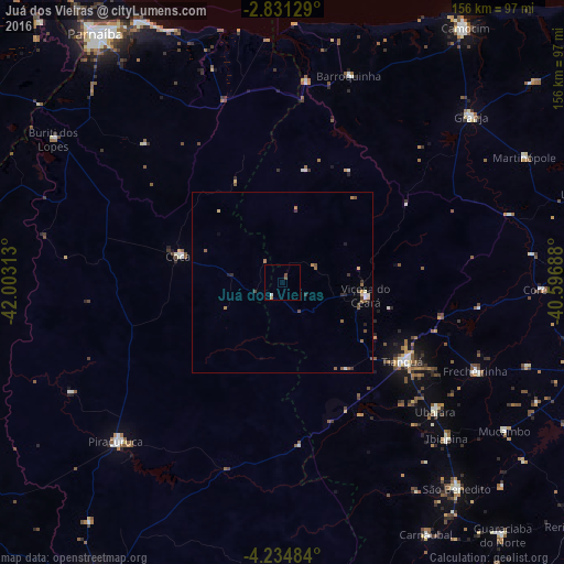
Analysis of Juá dos Vieiras night lights 2016
Square area 10x10 km:
 0%
0%90-99
0.87%80-89
0%70-79
0%60-69
0.87%50-59
0.22%40-49
1.52%30-39
0%20-29
0%10-19
0%0-9
96.54%Square area 50x50 km:
0.04%90-99
0.16%80-89
0.15%70-79
0.08%60-69
0.22%50-59
0.38%40-49
0.22%30-39
0.24%20-29
0.19%10-19
0.11%0-9
98.21%Clear (daylight) street map image can be seen on geolist.org.
Map coordinates:
2° 49' 52.6" South, 42° 0' 11.3" West
3° 31' 60" South, 41° 18' 0" West
4° 14' 5.4" South, 40° 35' 48.8" West
Some cities around Juá dos Vieiras sort by population:
• Tianguá
40.7 km =25.3 mi,  122°
122°
• Granja
69.8 km =43.4 mi,  48°
48°
• Piracuruca
63.1 km =39.2 mi,  225°
225°
• Viçosa do Ceará
23.3 km =14.5 mi,  97°
97°
• Ubajara
55.2 km =34.3 mi,  130°
130°
• Barroquinha
60 km =37.3 mi,  17°
17°
• Cocal
29.4 km =18.3 mi,  283°
283°
• Ibiapina
62.9 km =39.1 mi, 133°
3397188 (p: 6,215)
Sources (retrieved 2019-11-25):
» Earth at Night: Flat Maps 2012, 2016