Tutóia night lights from space
Night Light of Tutóia (Maranhão) from space (Brazil) Src. Average luminocity for 10x10km area is 9.9221% and for 50x50km: 0.993%.
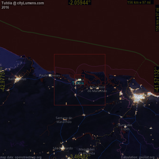
Analysis of Tutóia night lights 2016
Square area 10x10 km:
 0%
0%90-99
0.87%80-89
1.73%70-79
1.08%60-69
2.38%50-59
4.11%40-49
2.38%30-39
0.43%20-29
0.87%10-19
0%0-9
86.15%Square area 50x50 km:
0%90-99
0.07%80-89
0.12%70-79
0.1%60-69
0.18%50-59
0.49%40-49
0.25%30-39
0.12%20-29
0.12%10-19
0.09%0-9
98.46%Clear (daylight) street map image can be seen on geolist.org.
Map coordinates:
2° 3' 34" South, 42° 58' 39.3" West
2° 45' 43" South, 42° 16' 28" West
3° 27' 50.5" South, 41° 34' 16.8" West
Some cities around Tutóia sort by population:
• Parnaíba
57.5 km =35.7 mi,  106°
106°
• Barreirinhas
61.3 km =38.1 mi,  270°
270°
• Santa Quitéria do Maranhão
89.1 km =55.4 mi,  199°
199°
• Luzilândia
78.1 km =48.5 mi,  187°
187°
• Luís Correia
68.7 km =42.7 mi,  100°
100°
• São Bernardo
68.5 km =42.6 mi, 193°
• Buriti dos Lopes
64.5 km =40.1 mi,  135°
135°
• Araioses
43.6 km =27.1 mi, 109°
3385899 (p: 12,212)
Sources (retrieved 2019-11-25):
» Earth at Night: Flat Maps 2012, 2016