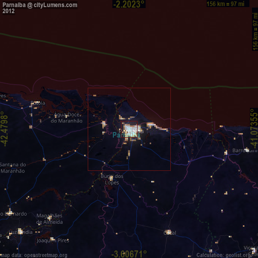
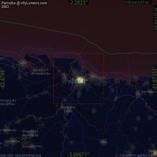
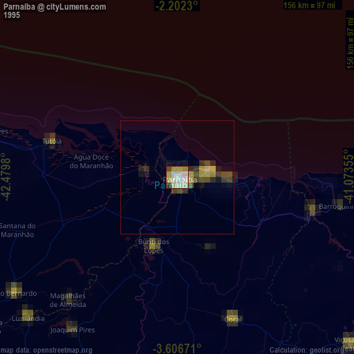
Parnaíba night lights from space
Night Light of Parnaíba (Piauí) from space (Brazil) Src. Average luminocity for 10x10km area is 62.4394% and for 50x50km: 7.8892%.
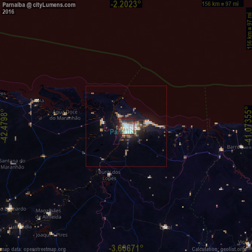
Analysis of Parnaíba night lights 2016
Square area 10x10 km:
 15.58%
90-99
21.86%80-89
5.84%70-79
3.03%60-69
4.11%50-59
6.49%40-49
8.87%30-39
6.49%20-29
21.43%10-19
6.28%0-9
0%Square area 50x50 km:
0.81%90-99
1.69%80-89
0.71%70-79
0.59%60-69
1%50-59
1.46%40-49
1.1%30-39
1.18%20-29
2.32%10-19
5.49%0-9
83.66%Clear (daylight) street map image can be seen on geolist.org.
Map coordinates:
2° 12' 8.3" South, 42° 28' 47.3" West
2° 54' 17" South, 41° 46' 36" West
3° 36' 24.2" South, 41° 4' 24.8" West
Some cities around Parnaíba sort by population:
• Barroquinha
72.3 km =44.9 mi,  100°
100°
• Tutóia
57.5 km =35.7 mi,  286°
286°
• Cocal
67.6 km =42 mi,  158°
158°
• Luís Correia
12.5 km =7.8 mi,  76°
76°
• São Bernardo
87.4 km =54.3 mi,  234°
234°
• Buriti dos Lopes
31.7 km =19.7 mi,  198°
198°
• Araioses
14.1 km =8.8 mi,  276°
276°
• Juá dos Vieiras
87.7 km =54.5 mi,  142°
142°
3393001 (p: 138,008)
Sources (retrieved 2019-11-25):
» NASA, Earths city lights 1995
» NASA city lights 2003
» Earth at Night: Flat Maps 2012, 2016