Araioses night lights from space
Night Light of Araioses (Maranhão) from space (Brazil) Src. Average luminocity for 10x10km area is 13.303% and for 50x50km: 6.625%.
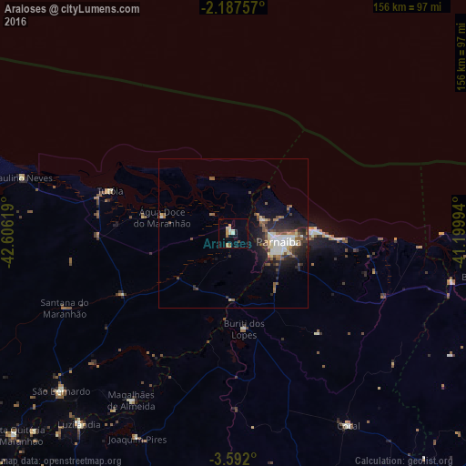
Analysis of Araioses night lights 2016
Square area 10x10 km:
 0.43%
0.43%90-99
3.03%80-89
1.73%70-79
3.68%60-69
1.52%50-59
0.87%40-49
0.87%30-39
0%20-29
0.43%10-19
3.03%0-9
84.42%Square area 50x50 km:
0.74%90-99
1.41%80-89
0.6%70-79
0.4%60-69
0.84%50-59
1.32%40-49
1.01%30-39
1.06%20-29
2.25%10-19
3.83%0-9
86.54%Clear (daylight) street map image can be seen on geolist.org.
Map coordinates:
2° 11' 15.3" South, 42° 36' 22.3" West
2° 53' 24" South, 41° 54' 11" West
3° 35' 31.2" South, 41° 11' 59.8" West
Some cities around Araioses sort by population:
• Parnaíba
14.1 km =8.8 mi,  96°
96°
• Luzilândia
81.7 km =50.8 mi,  219°
219°
• Barroquinha
86.4 km =53.7 mi, 99°
• Tutóia
43.6 km =27.1 mi,  289°
289°
• Cocal
75.2 km =46.7 mi,  149°
149°
• Luís Correia
26.2 km =16.3 mi,  87°
87°
• São Bernardo
77.5 km =48.2 mi,  227°
227°
• Buriti dos Lopes
31.9 km =19.8 mi,  172°
172°
3407351 (p: 8,667)
Sources (retrieved 2019-11-25):
» Earth at Night: Flat Maps 2012, 2016