Inhuma night lights from space
Night Light of Inhuma (Piauí) from space (Brazil) Src. Average luminocity for 10x10km area is 5.039% and for 50x50km: 0.8774%.
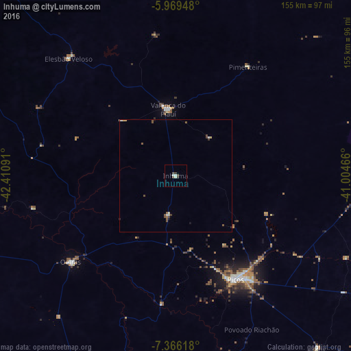
Analysis of Inhuma night lights 2016
Square area 10x10 km:
 0.22%
0.22%90-99
1.95%80-89
0.43%70-79
0%60-69
0%50-59
0.65%40-49
1.95%30-39
1.52%20-29
0.22%10-19
0%0-9
93.07%Square area 50x50 km:
0.06%90-99
0.16%80-89
0.1%70-79
0.07%60-69
0.04%50-59
0.29%40-49
0.29%30-39
0.12%20-29
0.05%10-19
0.1%0-9
98.7%Clear (daylight) street map image can be seen on geolist.org.
Map coordinates:
5° 58' 10.1" South, 42° 24' 39.3" West
6° 40' 6" South, 41° 42' 28" West
7° 21' 58.2" South, 41° 0' 16.8" West
Some cities around Inhuma sort by population:
• Picos
52.6 km =32.7 mi,  149°
149°
• Oeiras
61.3 km =38.1 mi,  229°
229°
• Valença do Piauí
29.3 km =18.2 mi,  351°
351°
• Parambu
123 km =76.4 mi,  65°
65°
• Regeneração
118.6 km =73.7 mi,  294°
294°
• Elesbão Veloso
70.5 km =43.8 mi,  317°
317°
• Jaicós
99.3 km =61.7 mi,  140°
140°
• Simplício Mendes
133.7 km =83.1 mi,  189°
189°
3398178 (p: 7,056)
Sources (retrieved 2019-11-25):
» Earth at Night: Flat Maps 2012, 2016