Jaicós night lights from space
Night Light of Jaicós (Piauí) from space (Brazil) Src. Average luminocity for 10x10km area is 6.4632% and for 50x50km: 0.7164%.
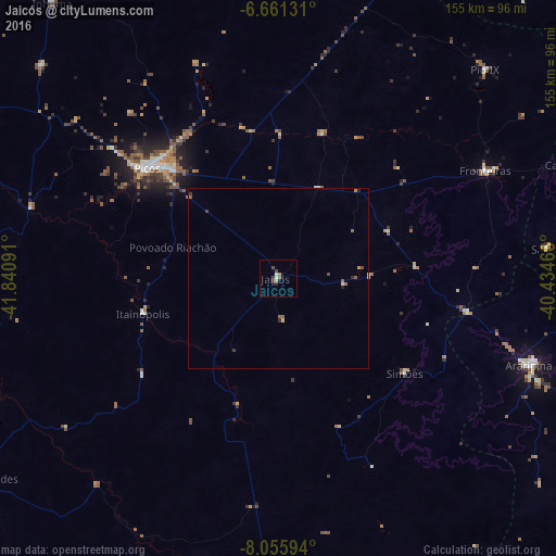
Analysis of Jaicós night lights 2016
Square area 10x10 km:
 0.43%
0.43%90-99
1.08%80-89
1.08%70-79
0.87%60-69
0%50-59
0.87%40-49
2.6%30-39
0.87%20-29
1.73%10-19
1.52%0-9
88.96%Square area 50x50 km:
0.02%90-99
0.11%80-89
0.08%70-79
0.07%60-69
0.07%50-59
0.25%40-49
0.2%30-39
0.12%20-29
0.15%10-19
0.09%0-9
98.84%Clear (daylight) street map image can be seen on geolist.org.
Map coordinates:
6° 39' 40.7" South, 41° 50' 27.3" West
7° 21' 33" South, 41° 8' 16" West
8° 3' 21.4" South, 40° 26' 4.8" West
Some cities around Jaicós sort by population:
• Picos
48 km =29.8 mi,  310°
310°
• Araripina
74.5 km =46.3 mi,  108°
108°
• Trindade
105.8 km =65.7 mi,  115°
115°
• Campos Sales
89.8 km =55.8 mi,  69°
69°
• Ipueiras
84.1 km =52.3 mi,  64°
64°
• Araripe
111.6 km =69.3 mi,  81°
81°
• Simplício Mendes
101.4 km =63 mi,  237°
237°
• Inhuma
99.3 km =61.7 mi,  320°
320°
3397660 (p: 7,107)
Sources (retrieved 2019-11-25):
» Earth at Night: Flat Maps 2012, 2016