Regeneração night lights from space
Night Light of Regeneração (Piauí) from space (Brazil) Src. Average luminocity for 10x10km area is 8.4372% and for 50x50km: 1.015%.
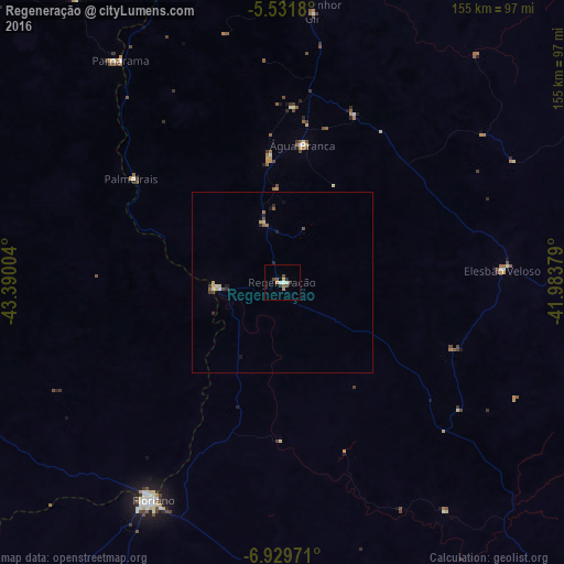
Analysis of Regeneração night lights 2016
Square area 10x10 km:
 0%
0%90-99
2.6%80-89
0%70-79
1.52%60-69
1.08%50-59
1.3%40-49
3.03%30-39
1.3%20-29
1.3%10-19
0%0-9
87.88%Square area 50x50 km:
0.03%90-99
0.17%80-89
0.18%70-79
0.09%60-69
0.11%50-59
0.16%40-49
0.26%30-39
0.12%20-29
0.28%10-19
0.13%0-9
98.47%Clear (daylight) street map image can be seen on geolist.org.
Map coordinates:
5° 31' 54.5" South, 43° 23' 24.1" West
6° 13' 52.4" South, 42° 41' 12.9" West
6° 55' 47" South, 41° 59' 1.6" West
Some cities around Regeneração sort by population:
• Floriano
70.2 km =43.6 mi,  211°
211°
• Estreito
79.7 km =49.5 mi,  308°
308°
• Água Branca
38.1 km =23.7 mi,  8°
8°
• Parnarama
75.9 km =47.2 mi,  323°
323°
• Elesbão Veloso
60.5 km =37.6 mi,  86°
86°
• Amarante
17.6 km =10.9 mi,  265°
265°
• São Pedro do Piauí
33.7 km =20.9 mi,  354°
354°
• Beneditinos
93.8 km =58.3 mi,  22°
22°
3390700 (p: 13,608)
Sources (retrieved 2019-11-25):
» Earth at Night: Flat Maps 2012, 2016