Goiânia night lights from space
Night Light of Goiânia (Goiás) from space (Brazil) Src. Average luminocity for 10x10km area is 98.2446% and for 50x50km: 40.0956%.
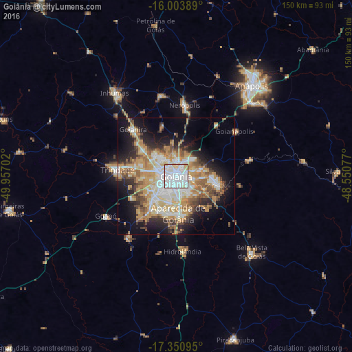
Analysis of Goiânia night lights 2016
Square area 10x10 km:
 69.05%
90-99
22.73%80-89
7.58%70-79
0.65%60-69
0%50-59
0%40-49
0%30-39
0%20-29
0%10-19
0%0-9
0%Square area 50x50 km:
7.96%90-99
7.97%80-89
4.79%70-79
9.92%60-69
4.73%50-59
4.42%40-49
4.98%30-39
2.95%20-29
6.52%10-19
12.01%0-9
33.74%Clear (daylight) street map image can be seen on geolist.org.
Map coordinates:
16° 0' 14" South, 49° 57' 25.3" West
16° 40' 43" South, 49° 15' 14" West
17° 21' 3.4" South, 48° 33' 2.8" West
Some cities around Goiânia sort by population:
• Aparecida de Goiânia
16.1 km =10 mi,  176°
176°
• Trindade
25.2 km =15.7 mi,  277°
277°
• Senador Canedo
17.4 km =10.8 mi,  100°
100°
• Inhumas
44 km =27.3 mi,  324°
324°
• Nerópolis
30.5 km =19 mi,  7°
7°
• Bela Vista de Goiás
45.8 km =28.5 mi,  135°
135°
• Guapó
34.1 km =21.2 mi,  240°
240°
• Hidrolândia
31.7 km =19.7 mi, 175°
3462377 (p: 1,171,195)
Sources (retrieved 2019-11-25):
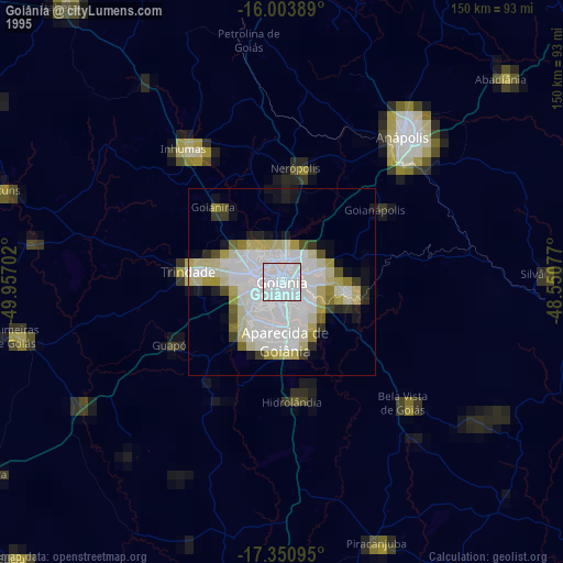
» NASA, Earths city lights 1995
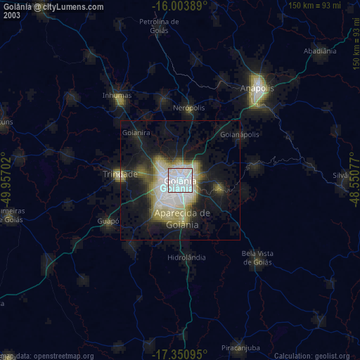
» NASA city lights 2003
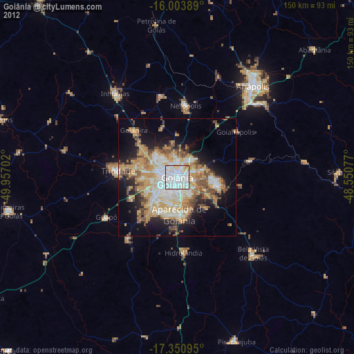
» Earth at Night: Flat Maps 2012, 2016