Bela Vista de Goiás night lights from space
Night Light of Bela Vista de Goiás (Goiás) from space (Brazil) Src. Average luminocity for 10x10km area is 24.9502% and for 50x50km: 3.0313%.
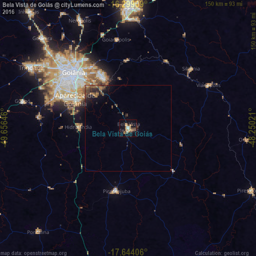
Analysis of Bela Vista de Goiás night lights 2016
Square area 10x10 km:
 2.81%
2.81%90-99
2.38%80-89
0%70-79
9.31%60-69
2.6%50-59
1.95%40-49
9.52%30-39
1.3%20-29
1.3%10-19
17.53%0-9
51.3%Square area 50x50 km:
0.12%90-99
0.11%80-89
0%70-79
0.61%60-69
0.59%50-59
0.63%40-49
1.11%30-39
0.54%20-29
0.98%10-19
2.19%0-9
93.12%Clear (daylight) street map image can be seen on geolist.org.
Map coordinates:
16° 17' 56.7" South, 49° 39' 23.3" West
16° 58' 22" South, 48° 57' 12" West
17° 38' 38.6" South, 48° 15' 0.8" West
Some cities around Bela Vista de Goiás sort by population:
• Goiânia
45.8 km =28.5 mi,  315°
315°
• Aparecida de Goiânia
35.1 km =21.8 mi,  298°
298°
• Senador Canedo
33 km =20.5 mi,  333°
333°
• Piracanjuba
37.3 km =23.2 mi,  190°
190°
• Silvânia
50.7 km =31.5 mi,  46°
46°
• Goianápolis
51.9 km =32.2 mi,  351°
351°
• Vianópolis
53.1 km =33 mi,  61°
61°
• Hidrolândia
29.2 km =18.1 mi,  272°
272°
3470164 (p: 14,289)
Sources (retrieved 2019-11-25):
» Earth at Night: Flat Maps 2012, 2016