Planaltina night lights from space
Night Light of Planaltina (Goiás) from space (Brazil) Src. Average luminocity for 10x10km area is 36.1472% and for 50x50km: 9.1207%.
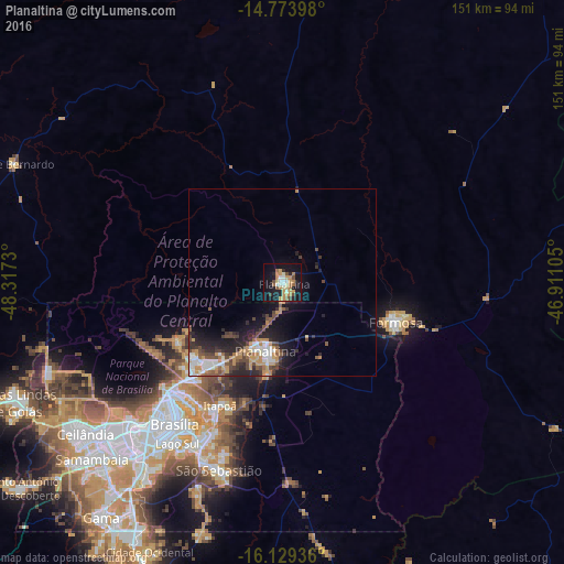
Analysis of Planaltina night lights 2016
Square area 10x10 km:
 2.81%
2.81%90-99
5.41%80-89
4.76%70-79
11.47%60-69
5.19%50-59
4.33%40-49
4.11%30-39
0.87%20-29
4.76%10-19
39.61%0-9
16.67%Square area 50x50 km:
1.16%90-99
1.37%80-89
0.48%70-79
2.38%60-69
0.9%50-59
1.07%40-49
1.9%30-39
1.17%20-29
2.8%10-19
5.86%0-9
80.91%Clear (daylight) street map image can be seen on geolist.org.
Map coordinates:
14° 46' 26.3" South, 48° 19' 2.3" West
15° 27' 10" South, 47° 36' 51" West
16° 7' 45.7" South, 46° 54' 39.8" West
Some cities around Planaltina sort by population:
• Brasília
49.6 km =30.8 mi,  222°
222°
• Luziânia
95.9 km =59.6 mi,  202°
202°
• Formosa
31.4 km =19.5 mi,  107°
107°
• Unaí
125.9 km =78.2 mi,  143°
143°
• Niquelândia
141.8 km =88.1 mi,  320°
320°
• Buritis
128.9 km =80.1 mi,  98°
98°
• Padre Bernardo
78.5 km =48.8 mi,  293°
293°
• Abadiânia
143.7 km =89.3 mi,  234°
234°
3453420 (p: 88,853)
Sources (retrieved 2019-11-25):
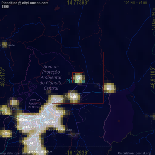
» NASA, Earths city lights 1995
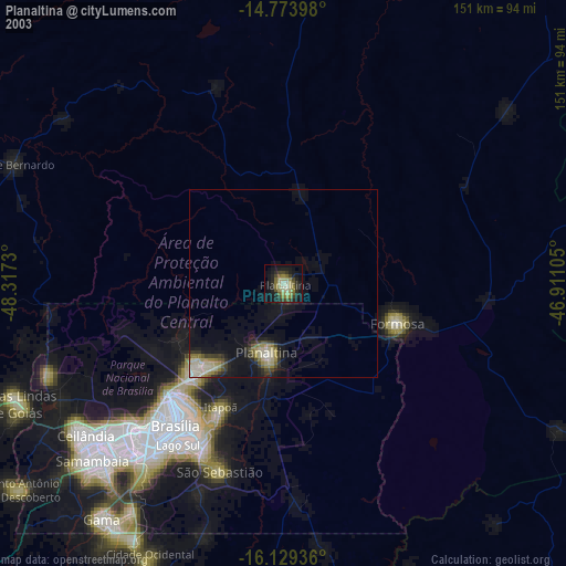
» NASA city lights 2003
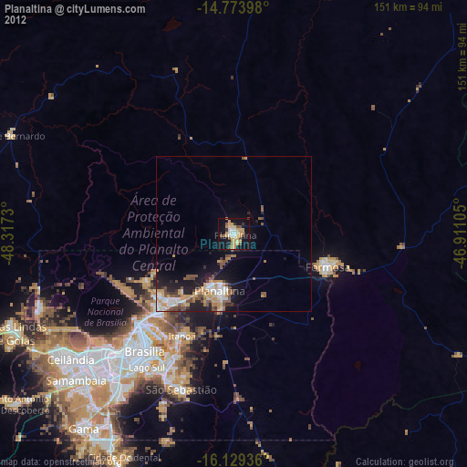
» Earth at Night: Flat Maps 2012, 2016