Conselheiro Lafaiete night lights from space
Night Light of Conselheiro Lafaiete (Minas Gerais) from space (Brazil) Src. Average luminocity for 10x10km area is 35.2746% and for 50x50km: 7.5319%.
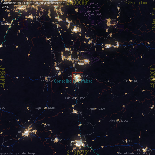
Analysis of Conselheiro Lafaiete night lights 2016
Square area 10x10 km:
 3.6%
3.6%90-99
3.79%80-89
5.68%70-79
8.14%60-69
8.33%50-59
4.73%40-49
2.84%30-39
2.84%20-29
2.65%10-19
39.58%0-9
17.8%Square area 50x50 km:
0.48%90-99
0.64%80-89
0.57%70-79
1.53%60-69
1.44%50-59
0.87%40-49
1.42%30-39
0.9%20-29
1.14%10-19
8.7%0-9
82.3%Clear (daylight) street map image can be seen on geolist.org.
Map coordinates:
20° 0' 3.5" South, 44° 29' 21.3" West
20° 39' 37" South, 43° 47' 10" West
21° 19' 0.3" South, 43° 4' 58.8" West
Some cities around Conselheiro Lafaiete sort by population:
• Barbacena
62.9 km =39.1 mi,  178°
178°
• Ouro Preto
41.6 km =25.8 mi,  44°
44°
• Congonhas
18.8 km =11.7 mi,  336°
336°
• Mariana
49.7 km =30.9 mi,  50°
50°
• Itabirito
45.3 km =28.1 mi,  357°
357°
• Ouro Branco
17.9 km =11.1 mi,  31°
31°
• Barroso
61.8 km =38.4 mi,  198°
198°
• Carandaí
32.7 km =20.3 mi, 183°
3465644 (p: 111,596)
Sources (retrieved 2019-11-25):
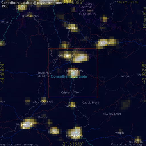
» NASA, Earths city lights 1995
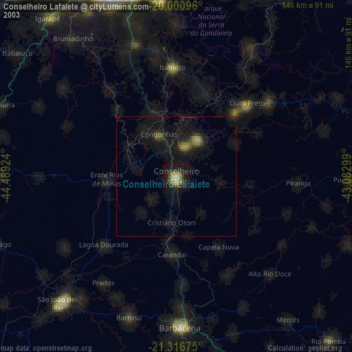
» NASA city lights 2003
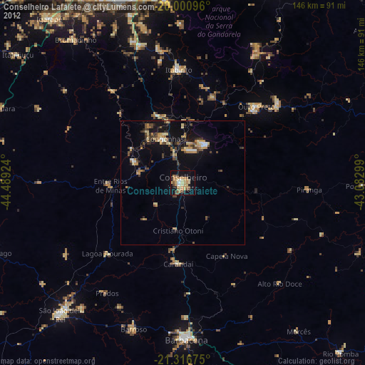
» Earth at Night: Flat Maps 2012, 2016