Campina Verde night lights from space
Night Light of Campina Verde (Minas Gerais) from space (Brazil) Src. Average luminocity for 10x10km area is 6.6839% and for 50x50km: 0.2676%.
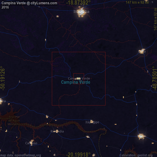
Analysis of Campina Verde night lights 2016
Square area 10x10 km:
 0%
0%90-99
0%80-89
0%70-79
3.31%60-69
4.13%50-59
0%40-49
0%30-39
0.62%20-29
1.03%10-19
0%0-9
90.91%Square area 50x50 km:
0%90-99
0%80-89
0%70-79
0.13%60-69
0.16%50-59
0%40-49
0%30-39
0.02%20-29
0.04%10-19
0%0-9
99.64%Clear (daylight) street map image can be seen on geolist.org.
Map coordinates:
18° 52' 26.1" South, 50° 11' 28.5" West
19° 32' 16.5" South, 49° 29' 17.3" West
20° 11' 57" South, 48° 47' 6" West
Some cities around Campina Verde sort by population:
• Ituiutaba
62.7 km =39 mi,  2°
2°
• Frutal
78.8 km =49 mi,  133°
133°
• Iturama
77 km =47.8 mi,  254°
254°
• Prata
64.5 km =40.1 mi,  66°
66°
• Capinópolis
95.6 km =59.4 mi,  354°
354°
• Monte Alegre de Minas
97.8 km =60.8 mi,  40°
40°
• Riolândia
53.3 km =33.1 mi,  202°
202°
• Cardoso
75.1 km =46.7 mi,  216°
216°
3467860 (p: 13,137)
Sources (retrieved 2019-11-25):
» Earth at Night: Flat Maps 2012, 2016