Prata night lights from space
Night Light of Prata (Minas Gerais) from space (Brazil) Src. Average luminocity for 10x10km area is 17.7771% and for 50x50km: 0.7306%.
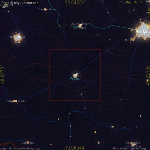
Analysis of Prata night lights 2016
Square area 10x10 km:
 0.87%
0.87%90-99
1.95%80-89
0.65%70-79
8.66%60-69
2.6%50-59
1.73%40-49
3.03%30-39
1.3%20-29
0%10-19
1.3%0-9
77.92%Square area 50x50 km:
0.03%90-99
0.07%80-89
0.02%70-79
0.32%60-69
0.1%50-59
0.06%40-49
0.14%30-39
0.06%20-29
0.02%10-19
0.05%0-9
99.11%Clear (daylight) street map image can be seen on geolist.org.
Map coordinates:
18° 38' 32.3" South, 49° 37' 38.3" West
19° 18' 26" South, 48° 55' 27" West
19° 58' 10" South, 48° 13' 15.8" West
Some cities around Prata sort by population:
• Uberlândia
80.5 km =50 mi,  57°
57°
• Ituiutaba
67.6 km =42 mi,  303°
303°
• Frutal
79.8 km =49.6 mi,  181°
181°
• Tupaciguara
82.8 km =51.4 mi,  16°
16°
• Conceição das Alagoas
87.8 km =54.6 mi,  140°
140°
• Campina Verde
64.5 km =40.1 mi,  246°
246°
• Monte Alegre de Minas
48.8 km =30.3 mi,  5°
5°
• Centralina
85.5 km =53.1 mi,  340°
340°
3452440 (p: 19,896)
Sources (retrieved 2019-11-25):
» Earth at Night: Flat Maps 2012, 2016