Cardoso night lights from space
Night Light of Cardoso (São Paulo) from space (Brazil) Src. Average luminocity for 10x10km area is 7.6151% and for 50x50km: 1.1503%.
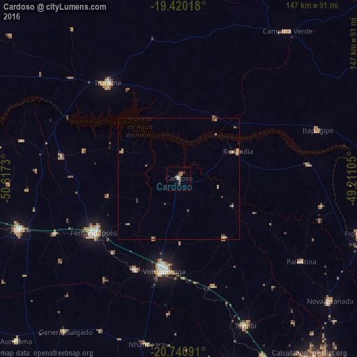
Analysis of Cardoso night lights 2016
Square area 10x10 km:
 0.4%
0.4%90-99
0.4%80-89
0.6%70-79
1.19%60-69
3.77%50-59
1.39%40-49
1.39%30-39
0.4%20-29
0.79%10-19
0.79%0-9
88.89%Square area 50x50 km:
0.04%90-99
0.06%80-89
0.02%70-79
0.49%60-69
0.35%50-59
0.15%40-49
0.28%30-39
0.15%20-29
0.15%10-19
0.1%0-9
98.21%Clear (daylight) street map image can be seen on geolist.org.
Map coordinates:
19° 25' 12.6" South, 50° 37' 2.3" West
20° 4' 55" South, 49° 54' 51" West
20° 44' 27.3" South, 49° 12' 39.8" West
Some cities around Cardoso sort by population:
• Votuporanga
38.4 km =23.9 mi,  189°
189°
• Fernandópolis
41.3 km =25.7 mi,  237°
237°
• Jales
69.1 km =42.9 mi,  252°
252°
• Iturama
49.1 km =30.5 mi,  323°
323°
• Tanabi
66.5 km =41.3 mi,  155°
155°
• Campina Verde
75.1 km =46.7 mi,  36°
36°
• Riolândia
26.7 km =16.6 mi,  65°
65°
• Nhandeara
68.9 km =42.8 mi, 191°
3466970 (p: 10,556)
Sources (retrieved 2019-11-25):
» Earth at Night: Flat Maps 2012, 2016