Pô night lights from space
Night Light of Pô (Centre-Sud) from space (Burkina Faso) Src. Average luminocity for 10x10km area is 3.461% and for 50x50km: 0.2856%.
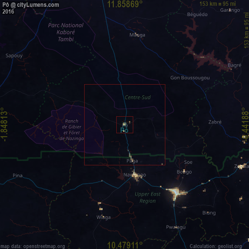
Analysis of Pô night lights 2016
Square area 10x10 km:
 0%
0%90-99
0%80-89
0.87%70-79
0.87%60-69
0%50-59
1.73%40-49
1.73%30-39
0%20-29
0%10-19
0.87%0-9
93.94%Square area 50x50 km:
0%90-99
0%80-89
0.03%70-79
0.03%60-69
0%50-59
0.1%40-49
0.21%30-39
0.1%20-29
0.06%10-19
0.03%0-9
99.42%Clear (daylight) street map image can be seen on geolist.org.
Map coordinates:
11° 51' 31.3" North, 1° 50' 53.3" West
11° 10' 11" North, 1° 8' 42" West
10° 28' 44.8" North, 0° 26' 30.8" West
Some cities around Pô sort by population:
• Bawku, GH
99.3 km =61.7 mi,  96°
96°
• Bolgatanga, GH
53.4 km =33.2 mi,  143°
143°
• Tenkodogo
108.4 km =67.4 mi,  51°
51°
• Kombissiri
102.1 km =63.4 mi,  348°
348°
• Garango
95.4 km =59.3 mi,  42°
42°
• Léo
105.2 km =65.4 mi,  265°
265°
• Navrongo, GH
31 km =19.3 mi,  169°
169°
• Manga
55.5 km =34.5 mi,  8°
8°
2356454 (p: 17,924)
Sources (retrieved 2019-11-25):
» Earth at Night: Flat Maps 2012, 2016