Eupen night lights from space
Night Light of Eupen (Wallonia) from space (Belgium) Src. Average luminocity for 10x10km area is 17.7045% and for 50x50km: 13.683%.
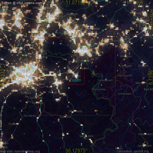
Analysis of Eupen night lights 2016
Square area 10x10 km:
 2.67%
2.67%90-99
3.74%80-89
2.14%70-79
1.2%60-69
0.94%50-59
2.41%40-49
2.41%30-39
1.74%20-29
0.94%10-19
21.26%0-9
60.56%Square area 50x50 km:
1.84%90-99
2.23%80-89
1.24%70-79
0.92%60-69
1.83%50-59
1.98%40-49
2.04%30-39
2.63%20-29
4.92%10-19
12.73%0-9
67.65%Clear (daylight) street map image can be seen on geolist.org.
Map coordinates:
51° 4' 18.6" North, 5° 20' 0.1" East
50° 37' 40.4" North, 6° 2' 11.3" East
50° 10' 47.1" North, 6° 44' 22.6" East
Some cities around Eupen sort by population:
• Verviers
13 km =8.1 mi,  250°
250°
• Dison
13.1 km =8.1 mi,  261°
261°
• La Calamine
10.2 km =6.3 mi,  349°
349°
• Raeren
7.1 km =4.4 mi,  51°
51°
• Welkenraedt
5.9 km =3.7 mi,  307°
307°
• Roetgen, DE
11.8 km =7.3 mi,  77°
77°
• Jalhay
9.1 km =5.7 mi,  212°
212°
• Limbourg
6.9 km =4.3 mi, 255°
2798573 (p: 18,029)
Sources (retrieved 2019-11-25):
» Earth at Night: Flat Maps 2012, 2016