Raeren night lights from space
Night Light of Raeren (Wallonia) from space (Belgium) Src. Average luminocity for 10x10km area is 6.8102% and for 50x50km: 14.4428%.
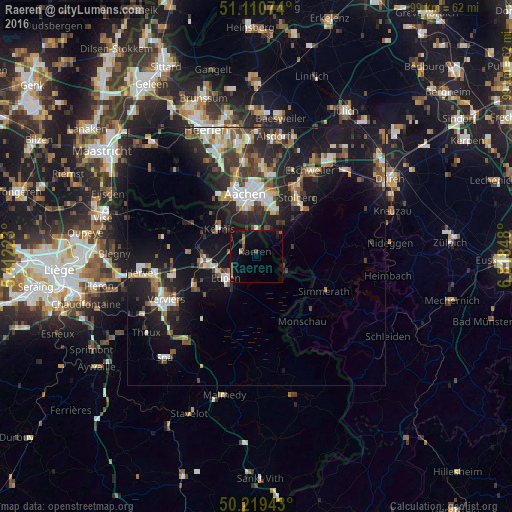
Analysis of Raeren night lights 2016
Square area 10x10 km:
 0%
0%90-99
0%80-89
0%70-79
1.07%60-69
1.07%50-59
0.53%40-49
1.6%30-39
0.94%20-29
1.74%10-19
8.29%0-9
84.76%Square area 50x50 km:
1.82%90-99
2.61%80-89
1.31%70-79
1.04%60-69
1.78%50-59
2.25%40-49
2.11%30-39
2.48%20-29
4.76%10-19
14.48%0-9
65.34%Clear (daylight) street map image can be seen on geolist.org.
Map coordinates:
51° 6' 38.7" North, 5° 24' 44" East
50° 40' 1.9" North, 6° 6' 55.3" East
50° 13' 9.9" North, 6° 49' 6.5" East
Some cities around Raeren sort by population:
• Aachen, DE
12.4 km =7.7 mi,  349°
349°
• Eupen
7.1 km =4.4 mi,  231°
231°
• La Calamine
9.3 km =5.8 mi,  307°
307°
• Plombières
13.4 km =8.3 mi, 305°
• Welkenraedt
10.2 km =6.3 mi,  265°
265°
• Roetgen, DE
6.3 km =3.9 mi,  107°
107°
• Vaals, NL
13.4 km =8.3 mi,  329°
329°
• Limbourg
13.7 km =8.5 mi,  243°
243°
2788410 (p: 9,925)
Sources (retrieved 2019-11-25):
» Earth at Night: Flat Maps 2012, 2016