Vermont South night lights from space
Night Light of Vermont South (Victoria) from space (Australia) Src. Average luminocity for 10x10km area is 79.1266% and for 50x50km: 47.1439%.
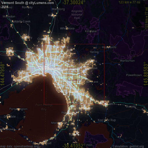
Analysis of Vermont South night lights 2016
Square area 10x10 km:
 16.72%
90-99
17.37%80-89
7.95%70-79
21.27%60-69
30.68%50-59
5.52%40-49
0.49%30-39
0%20-29
0%10-19
0%0-9
0%Square area 50x50 km:
11.67%90-99
10.76%80-89
5.9%70-79
8.65%60-69
7.89%50-59
5.81%40-49
3.74%30-39
3.19%20-29
4.49%10-19
7.48%0-9
30.43%Clear (daylight) street map image can be seen on geolist.org.
Map coordinates:
37° 18' 0.9" South, 144° 28' 46.5" East
37° 51' 26.9" South, 145° 10' 57.7" East
38° 24' 37.9" South, 145° 53' 9" East
Some cities around Vermont South sort by population:
• Glen Waverley
2.8 km =1.7 mi,  214°
214°
• Wheelers Hill
4.7 km =2.9 mi,  179°
179°
• Wantirna South
4.1 km =2.5 mi,  133°
133°
• Wantirna
3.1 km =1.9 mi,  74°
74°
• Nunawading
4.2 km =2.6 mi,  348°
348°
• Forest Hill
2.7 km =1.7 mi,  1°
1°
• Blackburn South
3.1 km =1.9 mi,  309°
309°
• Burwood East
3 km =1.9 mi,  286°
286°
9972487 (p: 11,503)
Sources (retrieved 2019-11-25):
» Earth at Night: Flat Maps 2012, 2016